MIS archives: page kept as it was, information may be out of date.
Google Ocean
Google Maps & Google Earth as visualization tools for marine data
Categories:
- Submarine cables
- Shipwrecks (French coasts)
- Coastal orthophoto
- Aerial photos
- Marine raster charts
- Marine vector maps
- World tide predictions
- Bathymetry
- Weather
- Magnetic declination
- Live AIS (Automatic Identification System) vessel tracking
- Navigation tool: parallel profiles for bathymetric surveys
Other links: weather, oceanography, marine biology & environment, shipwrecks, 3D marine models, aerial photos, marine maps, bathymetry, sidescan sonar images, multibeam sonar images, vessel tracking, atypical sites.
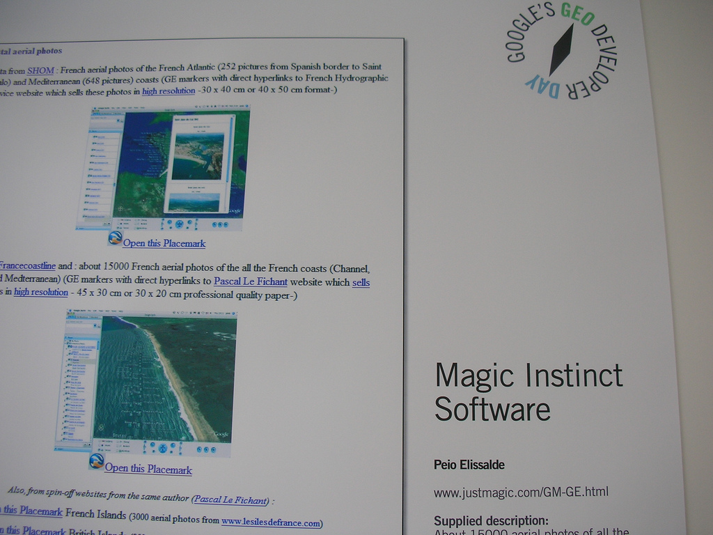
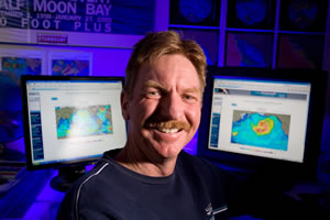
Google Ocean shown at the Google Geo Developer Day (12th June 2006).
Google Maps (GM) on the web and Google Earth (GE) as a 3D interactive atlas software application are ideal tools for sharing geographical information in a simple way. GE as a mass-market visualization product is definitely a new step in the evolution of mapping and GIS, especially in the way it can be used with a couple of mouse clicks by anybody not expert in cartography.
So this webpage is the MIS contribution to this unique method of information gathering to share detailed information in the marine domain waiting Google 3D Maps for Oceans (may be with Google Oceans as a product name, but name can change on its launch, probably on the 2nd of February, 2009), the future release of the Google project under research to create visualization tools for marine data throughout the world and will enable users to navigate below the sea surface. (CNET article)

“How inappropriate to call this planet Earth when it is quite clearly Ocean.” Sir Arthur C. Clarke
Indeed, Google launched in 2007 an advisory group (Google Oceans Advisory Council with 18 elite members, consisting mainly of oceanographers) to discuss creating a 3D map of the oceans. Some think that this could be an underwater version of “Google Earth” which could stimulate a lot of new interest in oceanography for showing sea behaviours, changing temperatures, weather patterns…
To get some ideas of the features we hope to see in this future implementation:
- GeoCoastPilot and GeoNav3D by CCOM/UNH
- COVE, a visual environment for Ocean Observatories
- Virtual Ocean, a WW Java application developed at LDEO as part of the Marine Geoscience Data System (MGDS)
So waiting this new software arrives, just download Google Earth, click on the different Placemarks links and you will be able to discover different marine data from your desktop.
Google just releases a new version of Google Earth v.5.0 on the 2nd of February 2009 allowing the exploration of the oceans: “Take a plunge into the oceans of the world” (Google Earth v.5.0).
1/ Submarine cables
- data from www.sigcables.com (France Telecom)
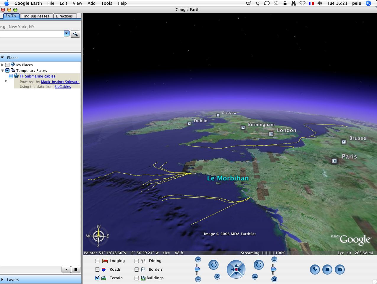
Note : waiting the arrival of seafloor DTM in future versions of GE (3D ocean mapping is on a to-do list of possible future enhancements, according to Google Earth CTO Michael Jones’s GIS day talk), all the geographical positions of the submarine cables are given in negative altitudes (depths).
- data from Kingfisher information service
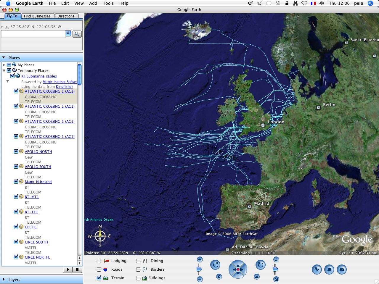
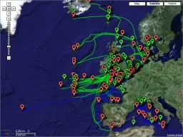
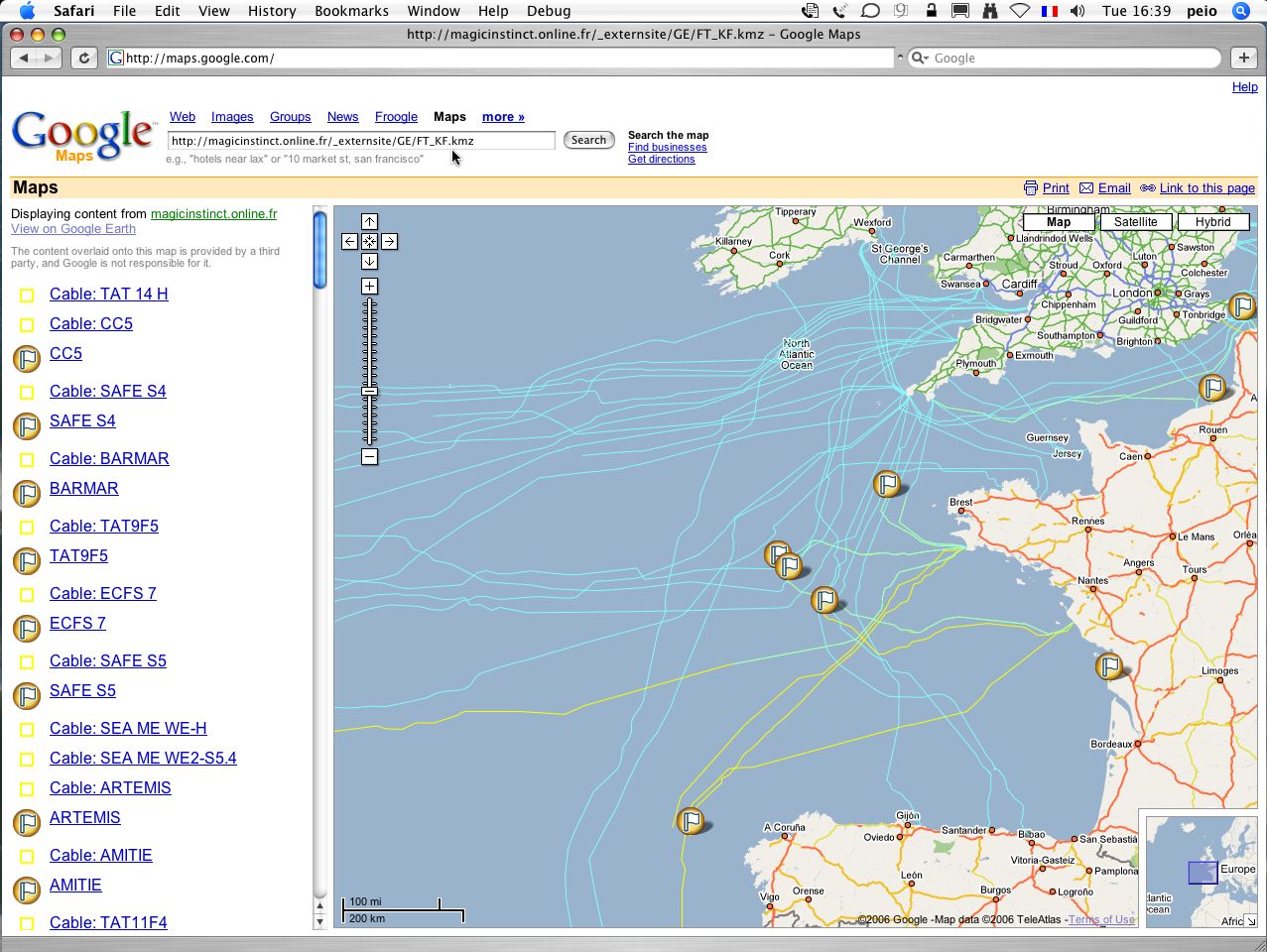
Submarine cables in Google Maps
France Telecom & KingFisher cables via kmz file in Google Maps: FT_KF.kmz (the original Google Maps link, which loaded this file, no longer works).
2/ Shipwrecks (French coasts)
- data courtesy of narcose29 (shipwrecks in Brittany, France, converted from ED50 datum to WGS84) (reproduction authorization from Michel, diver and creator of the original website)
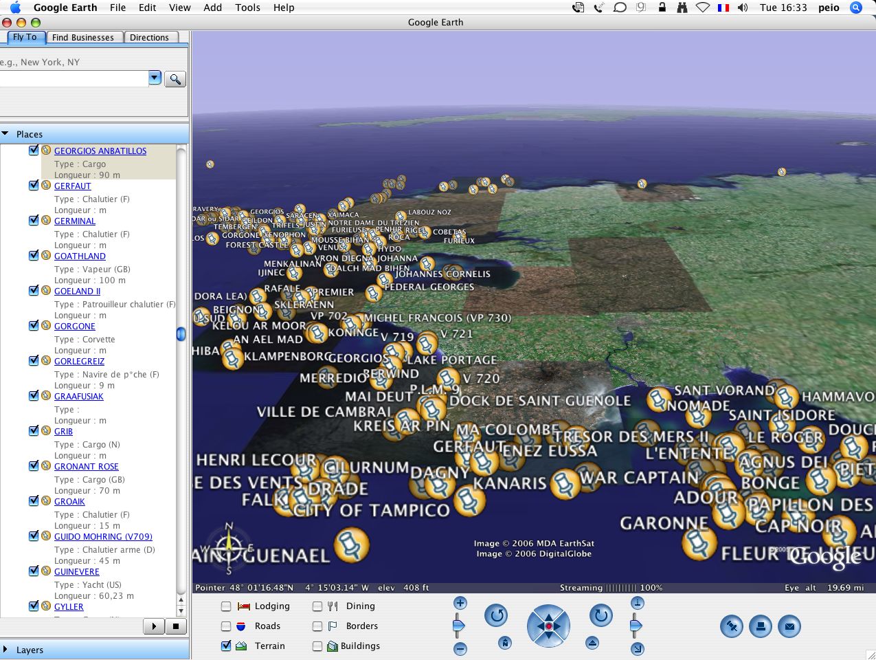
Google Maps: paste the web address of the Narcose29_GE.kmz file into the search form at http://maps.google.com
- data from Epaves (more than 3600 shipwrecks : France, Belgium, UK)
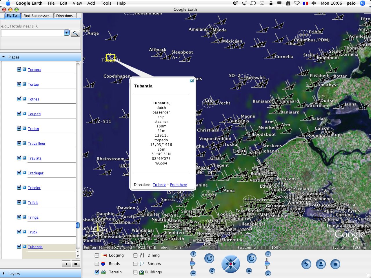
Open this Placemark
kmz file (with 2006 data) download no more available,
reproduction authorization refused by new site http://www.wrecksite.eu in 2008
- data from SHOM
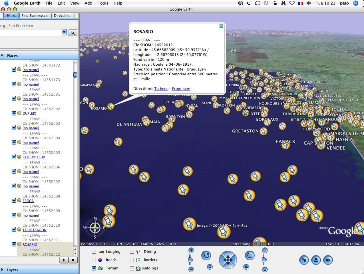
Open this Placemark
kmz file download unavailable, reproduction authorization refused by SHOM
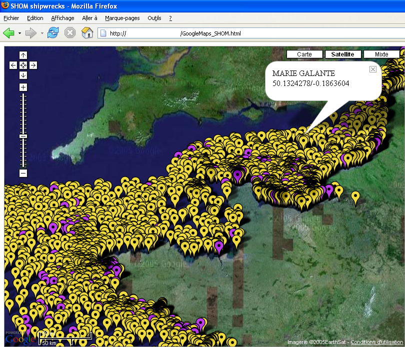 About 4000 shipwrecks and 800 obstructions in Google Maps
unavailable access, reproduction authorization refused by SHOM
About 4000 shipwrecks and 800 obstructions in Google Maps
unavailable access, reproduction authorization refused by SHOM
Note : as it’s impossible to load several thousands of markers directly with Google Maps, MIS has developed some tools to achieve this feature, allowing to set and run a geographical database (PostgreSQL/PostGIS) with all the data for order to only plot selective markers on the displayed map corresponding to the screen area.
3/ Coastal orthophoto
- data from siglittoral Ortholittorale 2000 : tiles originally in Lambert IIe / NGF (MrSid format)
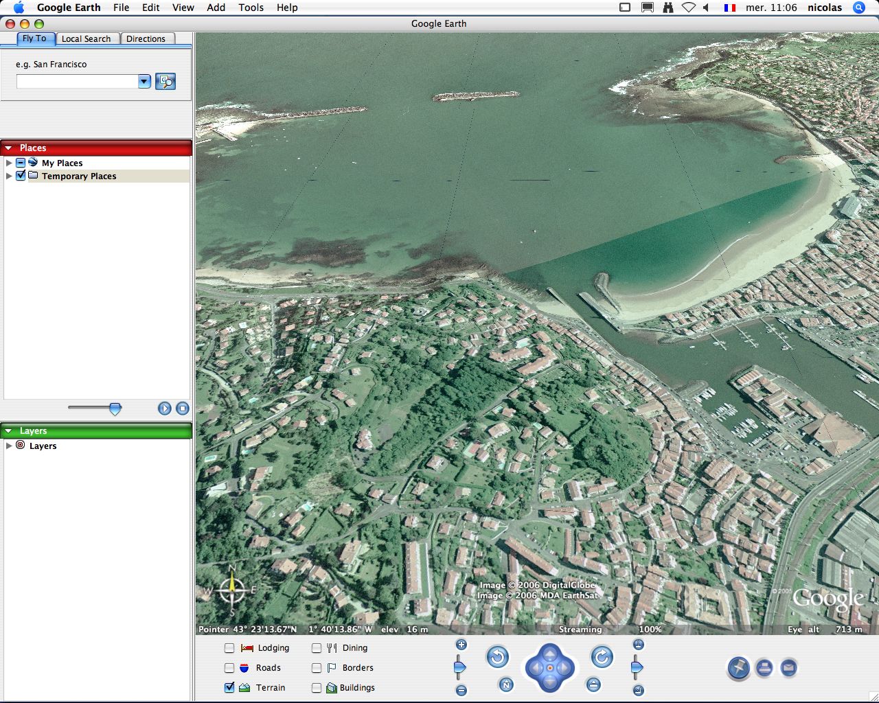 Open these Placemarks :
273-1832.kmz 274-1832.kmz 275-1832.kmz 276-1832.kmz
273-1831.kmz 274-1831.kmz 275-1831.kmz 276-1831.kmz
273-1830.kmz 274-1830.kmz 275-1830.kmz 276-1830.kmz
273-1829.kmz 274-1829.kmz 275-1829.kmz 276-1829.kmz
Open these Placemarks :
273-1832.kmz 274-1832.kmz 275-1832.kmz 276-1832.kmz
273-1831.kmz 274-1831.kmz 275-1831.kmz 276-1831.kmz
273-1830.kmz 274-1830.kmz 275-1830.kmz 276-1830.kmz
273-1829.kmz 274-1829.kmz 275-1829.kmz 276-1829.kmz
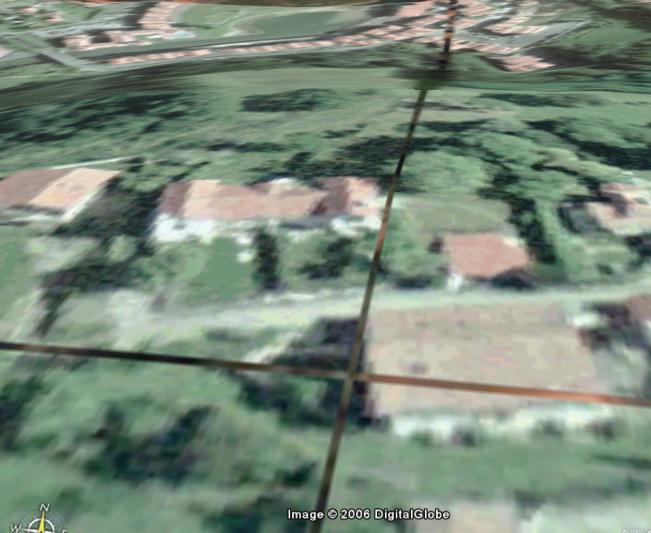
Note : originally, MIS has developed in 2006 some multi-resolution mosaicking tools to keep high resolution pictures of large areas in Google Earth. It seems there is some tricky behaviour in Google Earth concerning image overlays : all tiles fade out at the edges (global MIP map image processing tool chain issue concerning their client image overlay component ?); therefore the tiles are overlapping to get a seamless image… But we have choosen to not artificially overlap the different mosaïc tiles (cheating in the original positions of the edges in the goal to conserve a seamless vision).
With the arrival of kml v.2, MIS proposes ‘network links’ GM or GE solutions with possibilities of including affordable web hosting solutions (see GeoGarage) to allow easy and speedy visualization of large overlay areas such as high resolution aerial orthophotos.
So Ortholittorale 2000 is another example demonstrating that GeoGarage is able to manage a colossal volume of imagery. Actually, about 28500 raster tiles (each with a size of 1 km2 and a resolution of 2000x2000 pixels, 50 cm GSD) have been downloaded from siglittoral website. These coastal low tide orthophotographies (different from those presented on the Geoportail french national geoportal) covering all the Atlantic and Channel French littoral area represents 31.34 Gb of MrSid compressed image data (322 Gb in GeoTIFF format). They have been mosaiced with Quadtrimageo process developped by MIS, generating about 3 millions of PNG/JPG small georeferenced raster tiles hosted by the GeoGarage web spatial image server.
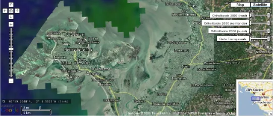 viewable in 2D with the GeoGarage Flash viewer / with Google Maps
- data from Brest Metropole Oceane : tiles originally in Lambert I / NGF (jpeg format) available under Creatice Commons license (Brest Moulin Blanc Harbour with Oceanopolis, aerial photo realized in september 2004 -resolution : 20 cm-)
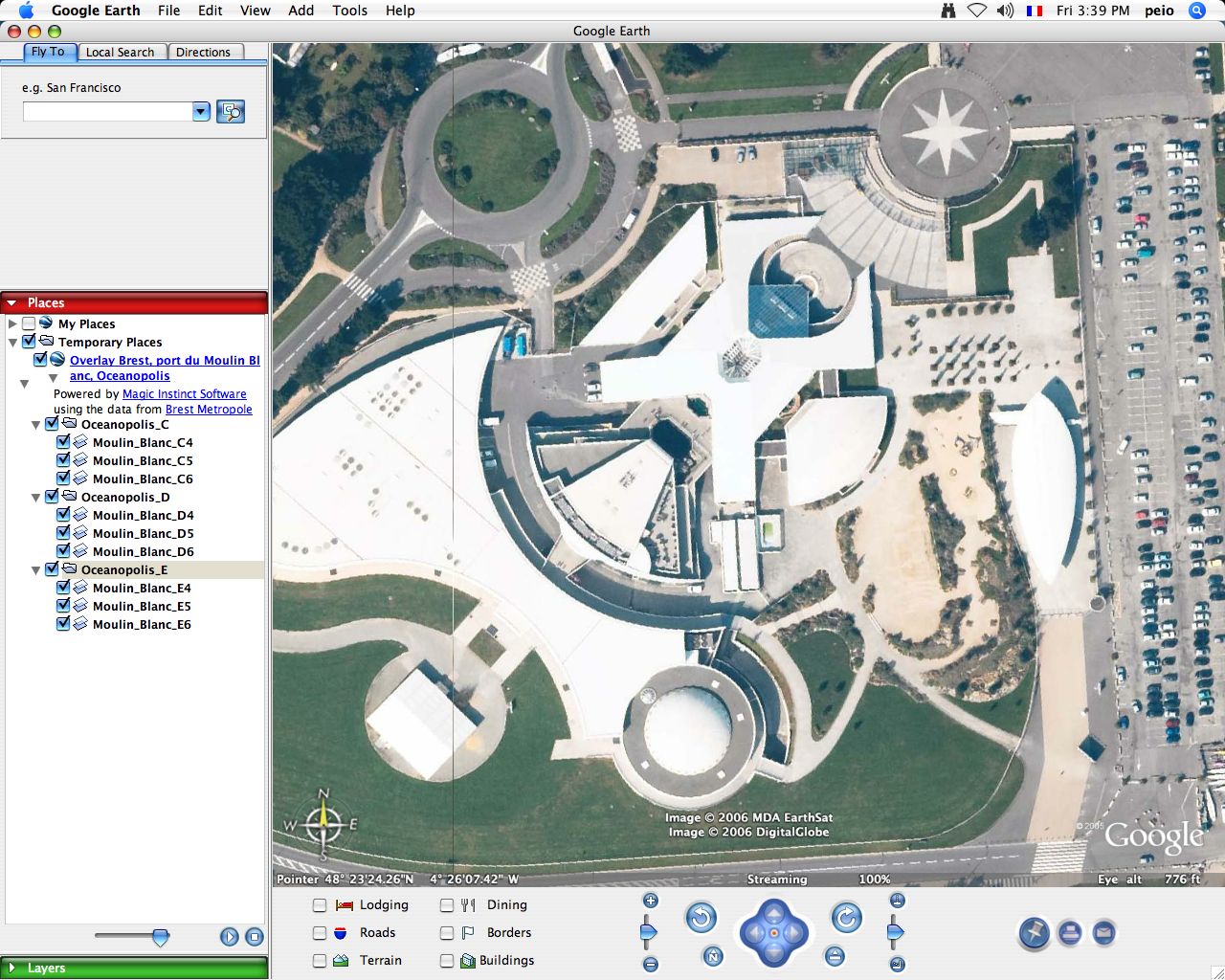 Open this Placemark :
Oceanopolis.kmz
Open this Placemark :
Oceanopolis.kmz
NEW : right now MIS proposes ‘network links’ GM or GE solutions with possibilities of including affordable web hosting solutions (see GeoGarage) to allow easy and speedy visualization of large overlay areas such as high resolution aerial orthophotos.
MIS has created some network links from the original file from Brest Metropole Océane. (1.573 gigabytes in ECW format / 11.25 gigapixels image -125000 x 90000 pixels-)
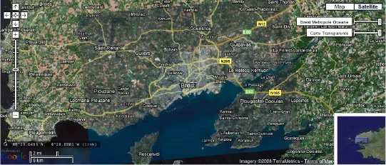
- viewable in 2D with the GeoGarage Flash viewer / with Google Maps
- in 3D with Google Earth: Brest_vu_du_ciel.kml
4/ Coastal aerial photos
- data from SHOM : French aerial photos of the French Atlantic (252 pictures from Spanish border to Saint Malo) and Mediterranean (648 pictures) coasts (GE markers with direct hyperlinks to French Hydrographic Service website which sells these photos in high resolution -30 x 40 cm or 40 x 50 cm format-)
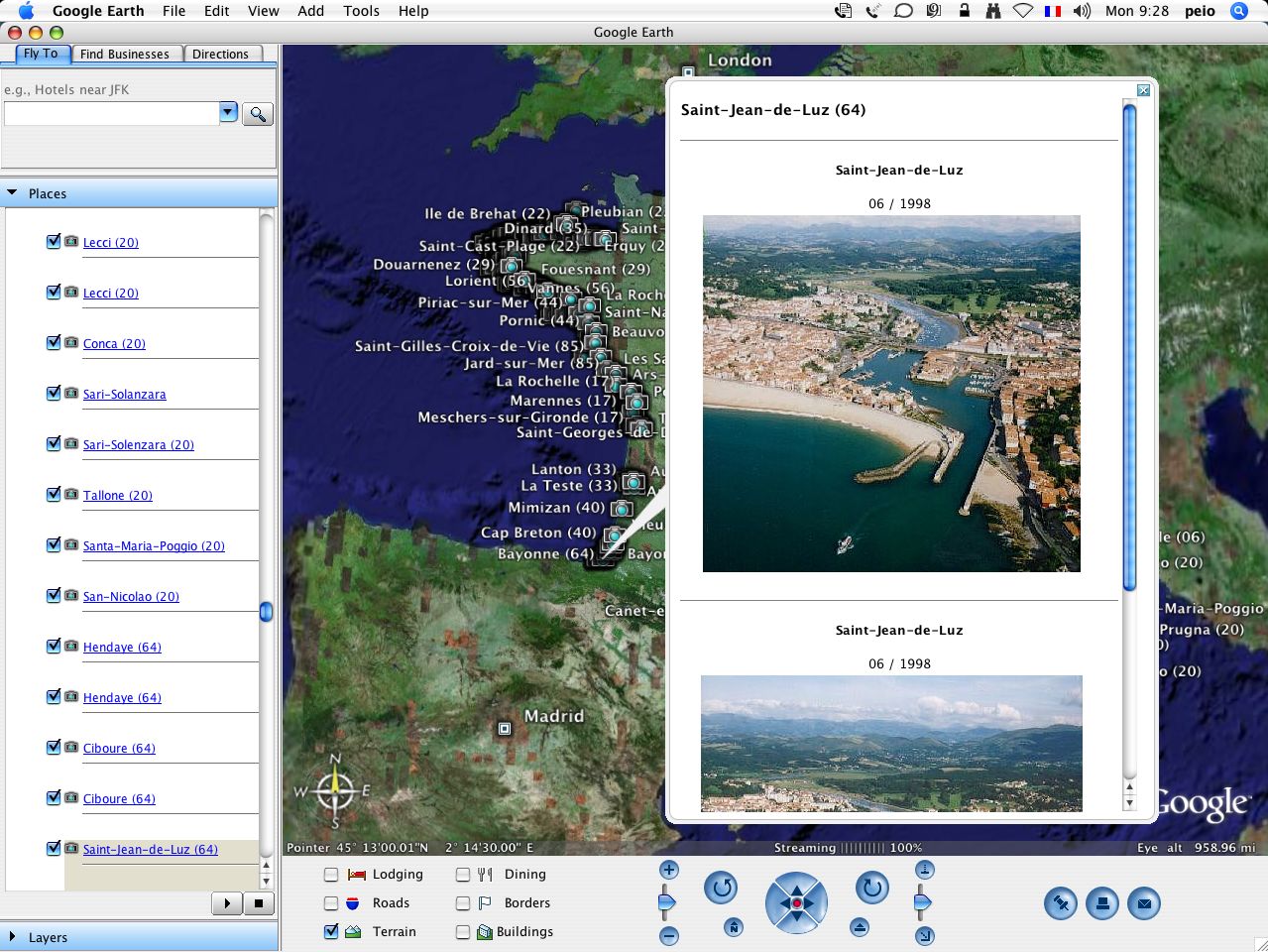
Update : in November 2008, SHOM has removed their folder of pictures from their website. So, our kmz network link is no more operational for viewing the demo pictures.
- data from Francecoastline (2006) : about 15000 French aerial photos of the all the French coasts (Channel, Atlantic and Medterranean) (GE markers with direct hyperlinks to Pascal Le Fichant website which sells these photos in high resolution - 45 x 30 cm or 30 x 20 cm professional quality paper-)
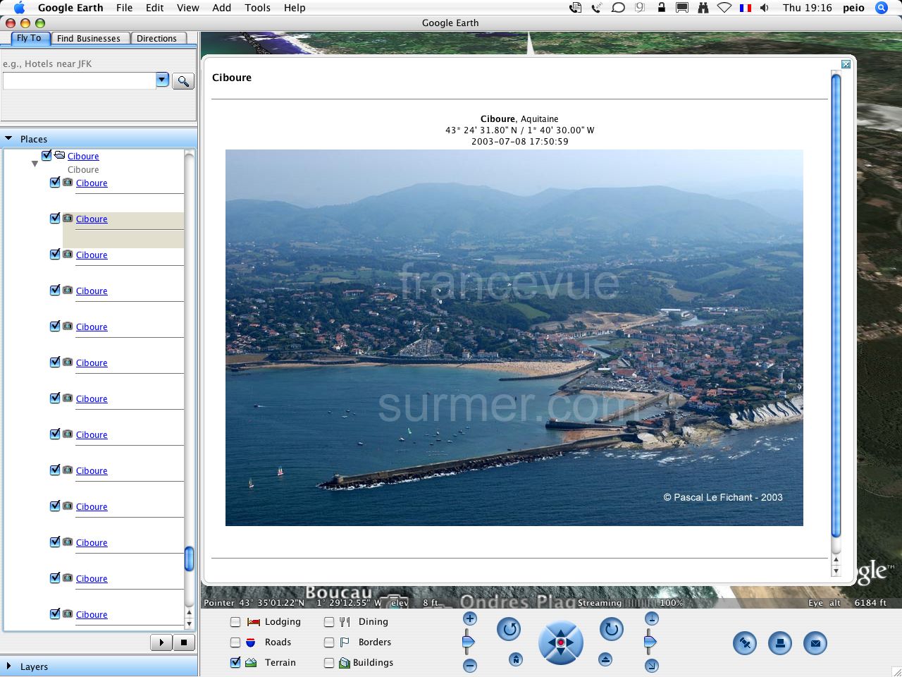
Open this Placemark
Also, from spin-off websites from the same author (Pascal Le Fichant): kmz file (with 2006 data) download no more available, reproduction authorization refused by Pascal Le Fichant in 2008.
Open this PlacemarkFrench Islands (3000 aerial photos from www.lesilesdefrance.com)Open this PlacemarkBritish Islands (850 aerial photos from www.british-islands.com)
5/ Marine raster chart
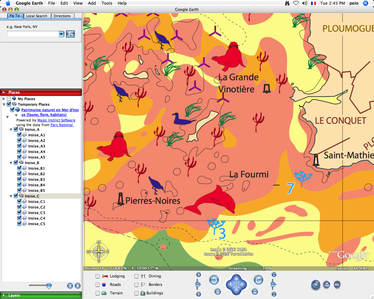
- data from Iroise Marine Park : chart describing wildlife, flora and sea resident in the Iroise Marine Park (France) originally in pdf converted in png image (600 dpi) and manually georeferenced.
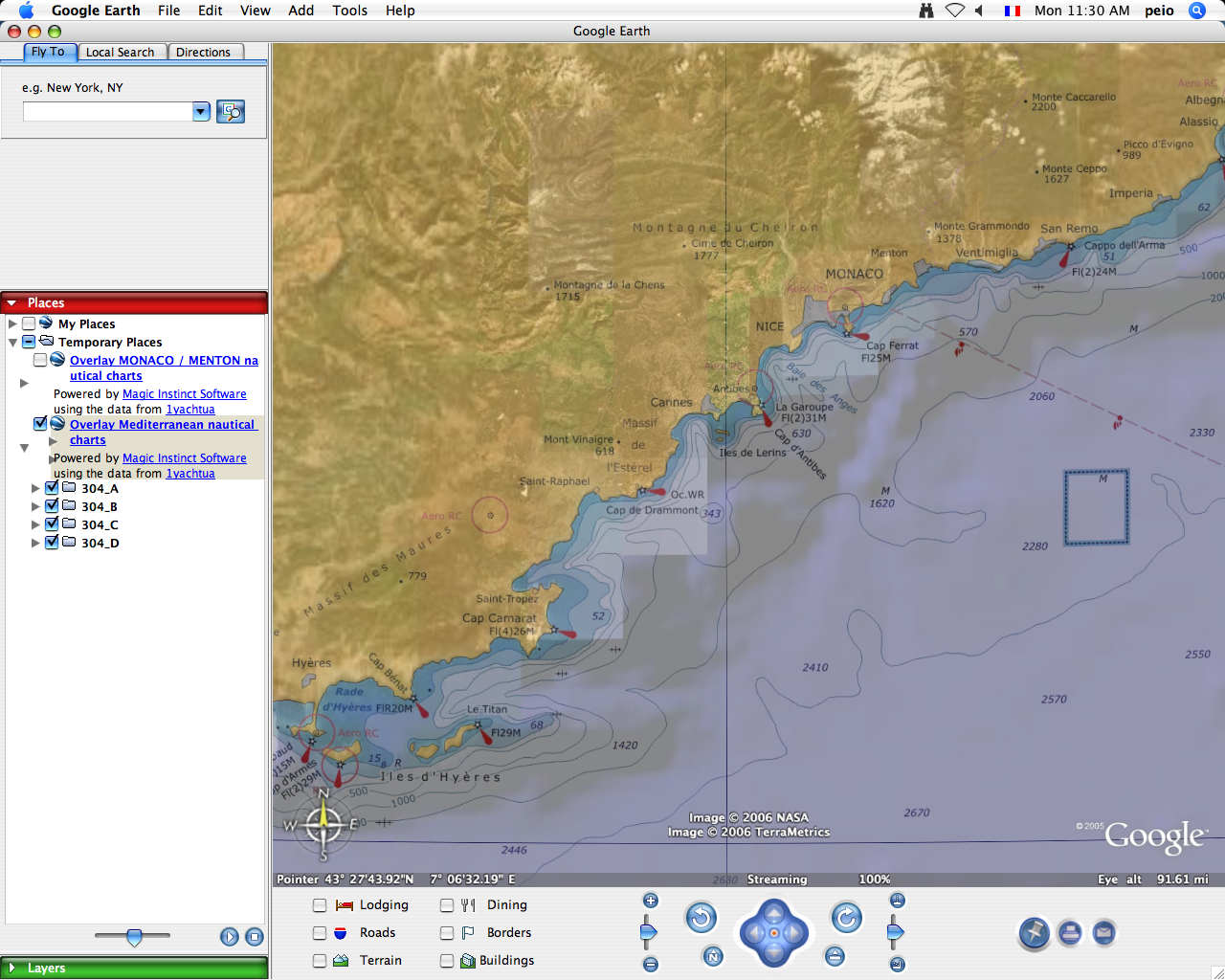
- data from 1yachtua : Mediterranean nautical charts including different scales maps (Port Monaco 1:15000 / Menton 1 : 20000) originally in GIF format, Mercator projection / ED50, manually georeferenced
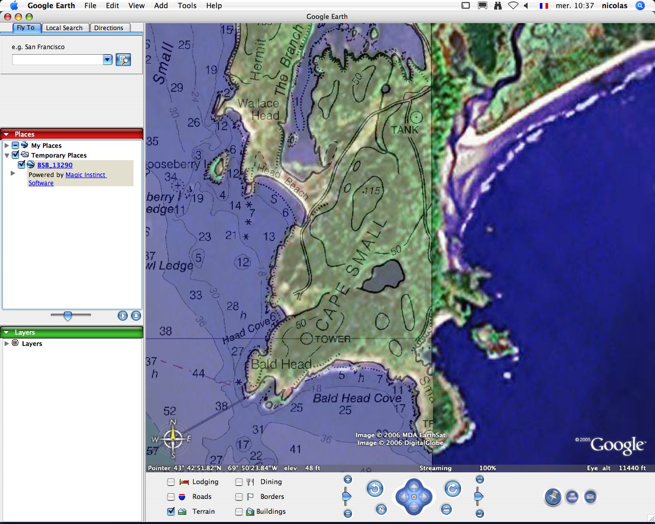
- data from NOAA : nautical chart originally in BSB (.kap) format, Mercator projection / NAD83
 Open these Placemarks :
BSB_13290_A.kmz BSB_13290_B.kmz BSB_13290_C.kmz
BSB_13290_D.kmz BSB_13290_E.kmz BSB_13290_F.kmz
Open these Placemarks :
BSB_13290_A.kmz BSB_13290_B.kmz BSB_13290_C.kmz
BSB_13290_D.kmz BSB_13290_E.kmz BSB_13290_F.kmz
Note : MIS has originally developed in 2006 some image manipulation and editing tools (borders’crop) for BSB nautical chart plus image reprojection The original chart has been cut horizontally in several pieces to keep its original resolution in GE v.3 because of the size of the raster chart leading to significant slowdowns : waiting a possible implementation in Google Earth of ISO-standard JPEG2000 image compression format storing geo-location metadata (using for example some KMLJP2 implementation such as GMLJP2 OpenGIS GML grammar…)
NEW : right now with kml version 2.1 and superoverlay features of GE v.4, MIS proposes ‘network links’ GM or GE solutions allowing to fetch KML data from remote servers. MIS offers affordable web hosting solutions (GeoGarage) to allow easy and speedy visualization of large overlay areas such as very high resolution maps.
BSB chart network link (for GE v.4) example for Casco Bay chart : BSB_13290.kml (no longer available)
About 1018 NOAA raster nautical charts (RNC/BSB/KAP format) stored in the GeoGarage can be viewed online with Google Maps (public access) or Google Earth (private access) with advanced quilting process (mosaic image with removed borders -map collars- for a seamless rendering display of multiple charts). So the user can access through Google viewers to all the range of NOAA raster maps, zooming in and out, panning in a continuous way for selecting the specified map scale automatically (so the appropriate map), by simply sliding the mouse roll.
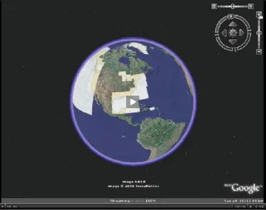 NOAA maps in Google Earth (video) : the network link is available through some private access
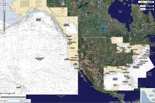 with Google Maps, in full screen with full transparency management via layer opacity sliders
(for terrestrial maps and orthophoto overlay) and Google local search (marinas, harbour services…)
(NOT TO BE USED FOR NAVIGATION)
with Google Maps, in full screen with full transparency management via layer opacity sliders
(for terrestrial maps and orthophoto overlay) and Google local search (marinas, harbour services…)
(NOT TO BE USED FOR NAVIGATION)
- data from Land Info New Zealand : nautical chart originally in TIFF format
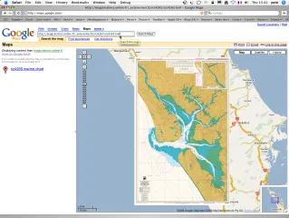
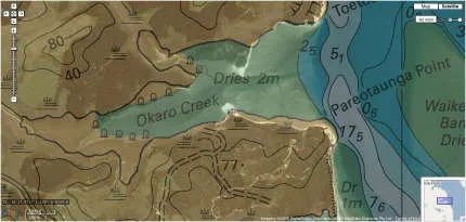
with GM classical solution : crude display when zooming
with the GeoGarage solution : perfect display at larger scales
11/21/2006 : Google gives the ability to show simple kml/kmz files (as made in GE) in GM : so you can add your own imagery directly on top of GM. To view a kml or kmz file on GM, just go to GM, and instead of searching for a geographical address, search for a complete web address (including the “http://” part) of your kmz file. But this is only OK for crude display of low-resolution raster files and with some approximated geo-positionning : GM uses Mercator projection and GE Plate Carrée (geographical) projection
NEW : as the size of the chart is important, you will see it’s quite long (or even impossible) to view the map using kml embedded raster file solution : so the basic overlayer in GM is not appropriate in this case without any raster tiling solutions. That’s why MIS has developed the GeoGarage spatial image server solution which can also be associated to the Google Maps viewer : raster charts tiling solution, with hosting possibilities.
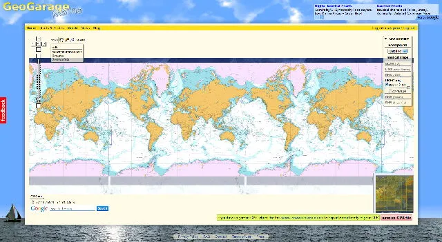
In March 2010, Magic Instinct Software has launched Marine GeoGarage, the nautical charts web portal
Our website is dedicated to any sailor or mariner who plans to study his next trip at sea, comfortably installed at home.
Marine GeoGarage has figured out a way to overlay a complete set of nautical raster charts over Google Maps. So nautical charts can be viewed online with advanced quilting process (mosaic image with removed borders -map collars- for a seamless rendering display of multiple charts), zooming in and out, panning in a continuous way for selecting the specified map scale automatically (so the appropriate map), by simply sliding the mouse roll, with full transparency management via layer opacity sliders (for terrestrial maps and orthophoto overlay) and Google local search (marinas, harbour services…)
Marine GeoGarage proposes a feature (without any Login process) where the user can drop waypoints and create custom routes but which can also be saved if the user asks for a free account.
What is really cool about the site is that you can export out those saved routes and move them over directly to your Garmin GPS unit via the Garmin Communicator Plugin.
Marine GeoGarage is world’s first nautical charts web portal -with data directly coming from International Hydrographic Services- built as a Software as a Service (SaaS) available in free and pay-per-use model.
What Marine GeoGarage changes is the concept of nautical electronic charts viewing: you don’t “own” anymore the charts, just “use” them and share them, anytime, anywhere you are via computer, mobile phone or any other Internet enabled personal device. The Cloud computing part of the service provides some resources in back-end to ensure regular processes for updating the charts (more than 3500 today) coming from the following international Hydrographic Services :
- NOAA US
- Linz NZ
- DHN Brazil
- UKHO UK
- SHN Argentina
- CHS Canada
- AHS Australia
6/ Marine vector maps
- ICES European fishing zones : data from International Council for the Exploration of the Sea (ICES) : original data in shapefile (ICES statistical rectangles provided by DIFRES Danish Fisheries and Research Institute).
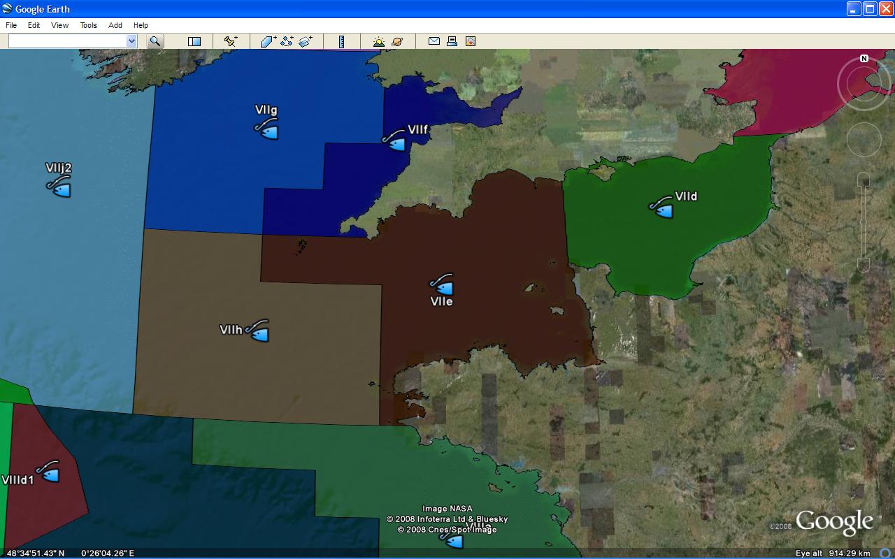 Open this Placemark
(10.2 Mb)
Open this Placemark
(10.2 Mb)
- World maritime boundaries (EEZ, Exclusive Economic Zone, is the zone extending 200 Nautical Miles from the baseline) : data from VLIZ : original data in shapefile
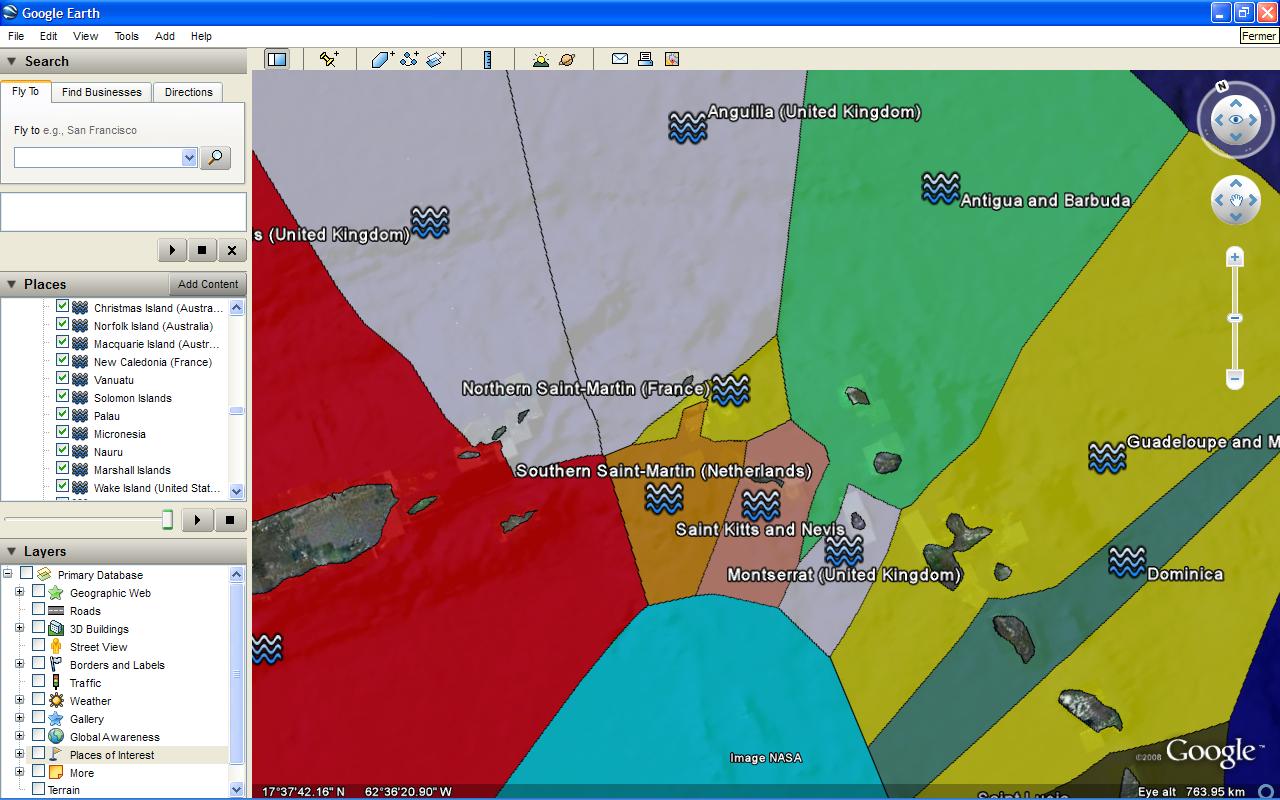 Open this Placemark
(2.4 Mb)
Open this Placemark
(2.4 Mb)
- ENC cells (Electronic Navigational Charts) catalogue in s-57/s-63 format : data from Primar
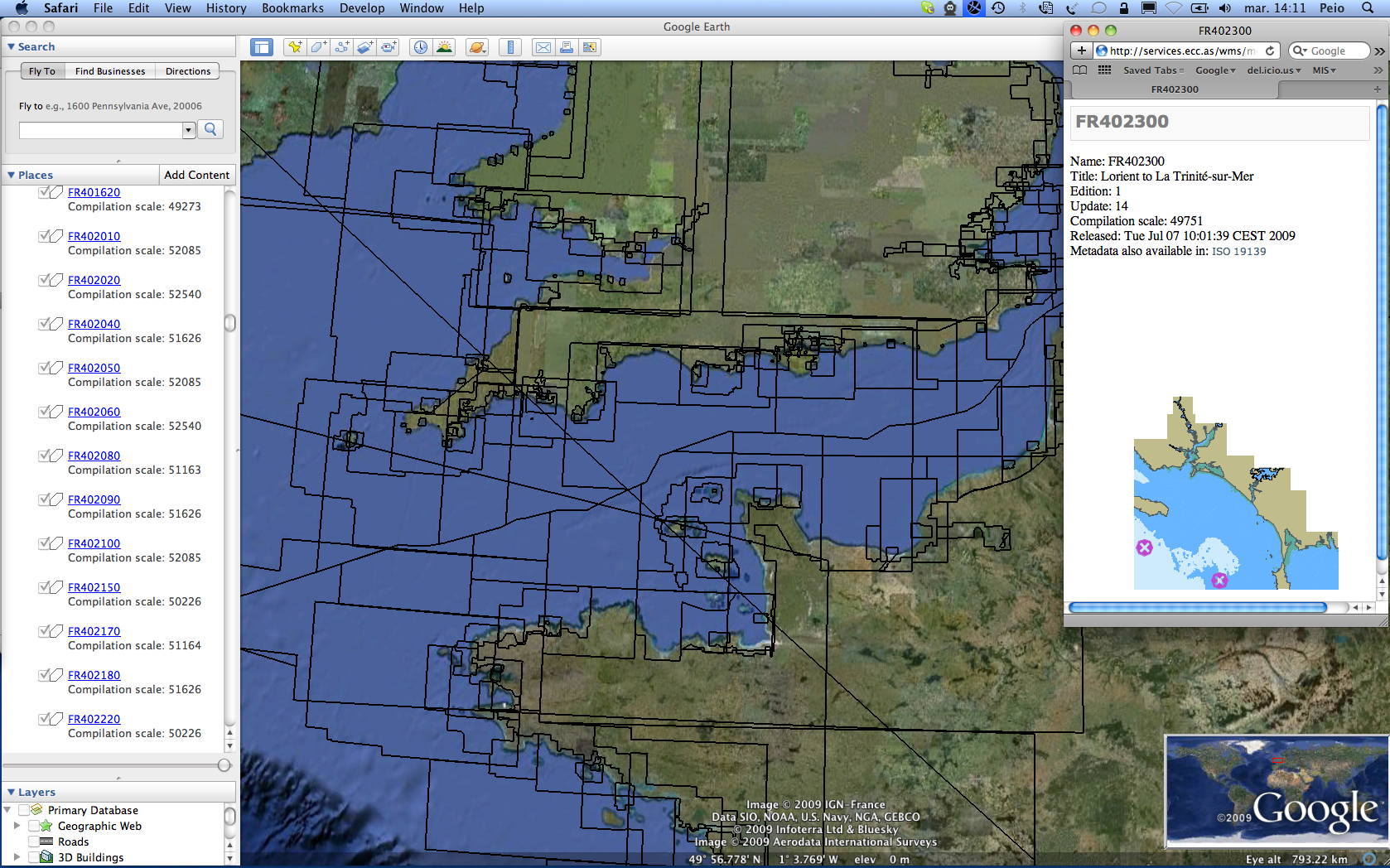 Open this Placemark
(0.9 Mb)
Open this Placemark
(0.9 Mb)
7/ Tide predictions for around the globe
- tidal information - current tides for over 7500 harbors - based on Xtide, the harmonic Tide Predictor and one of the many web server xttpd applications located at the University of Udinese (Italy)
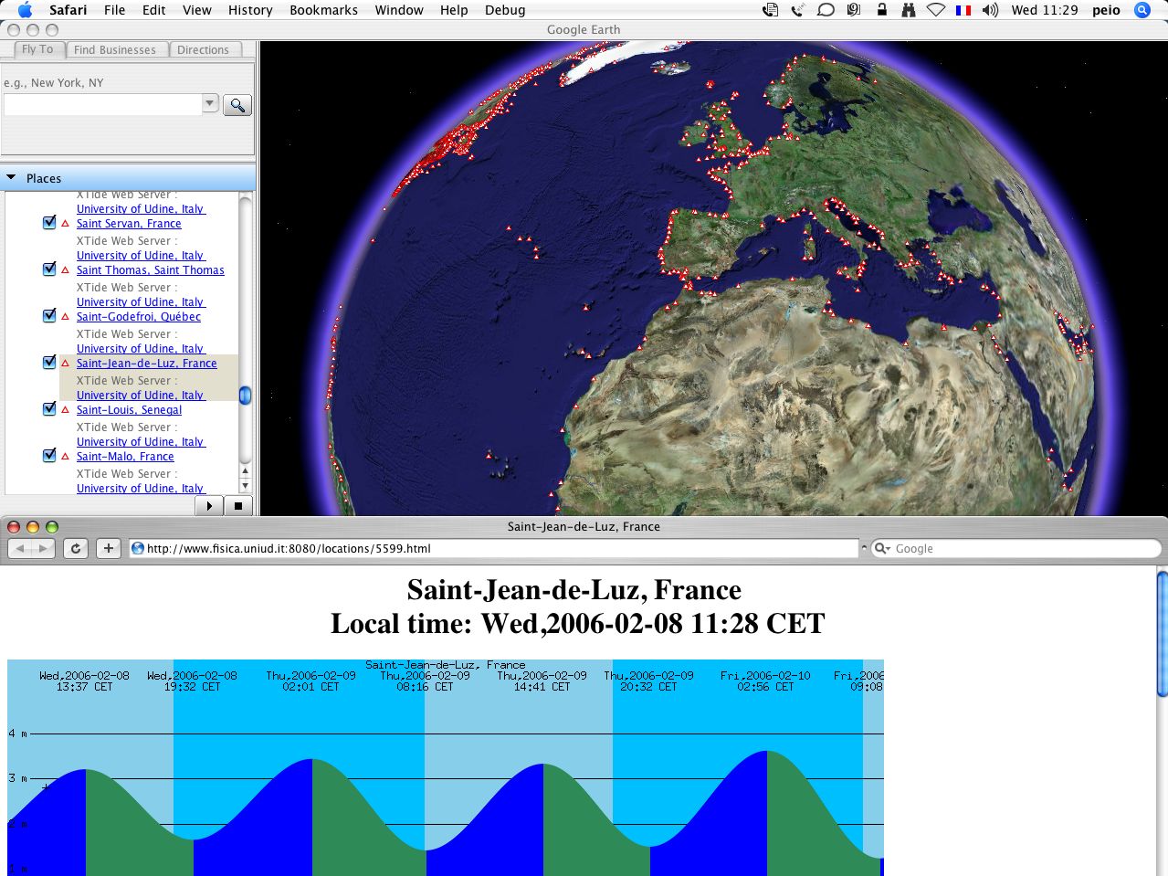
8/ Bathymetry
- data from National Geophysical Data Center (NGDC) : bathymetry and topography, 2 minute global relief, seafloor data from the work of Smith and Sandwell (1997) , NAVOCEANO and IBCAO plus GLOBE project for the land data.
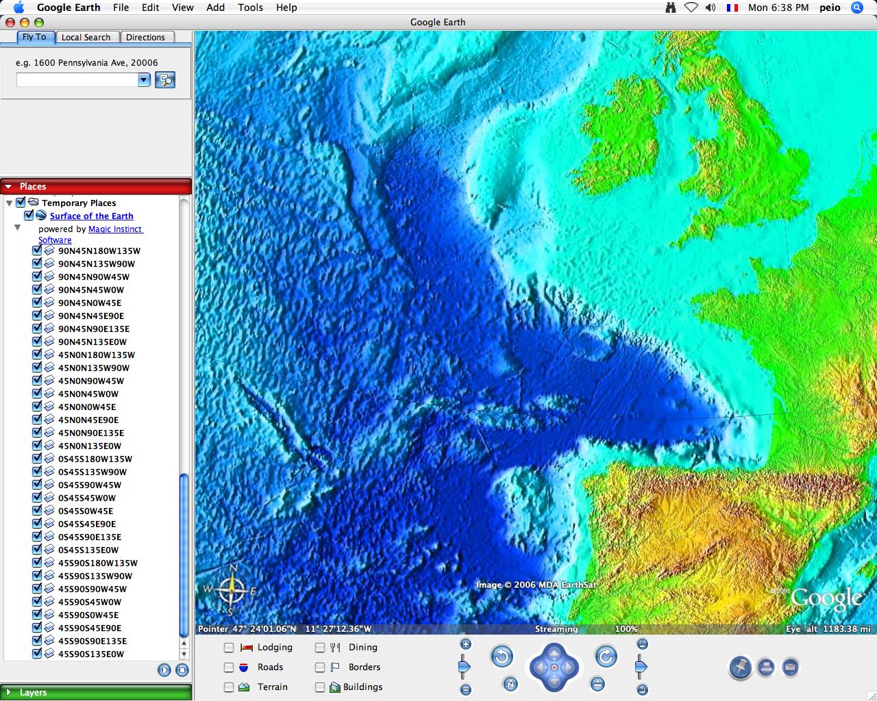
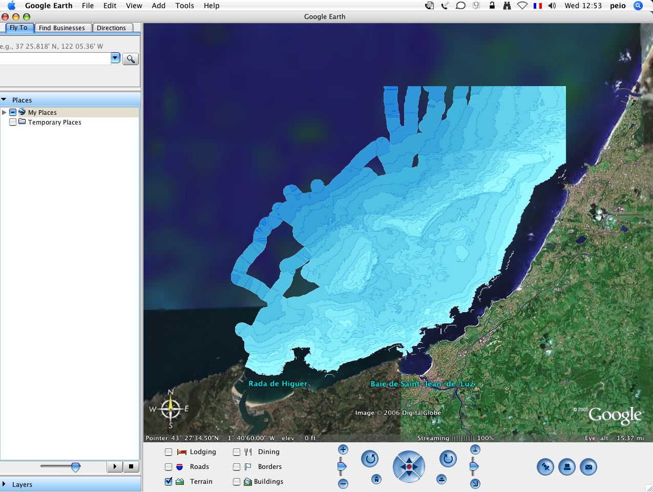
- data from user tracklines with depth info on Olex seafloor mapping software : chart originally in TIFF format, Mercator projection / WGS84 (reproduction authorization from Camille Clavier, fisherman in Saint Jean de Luz, France )
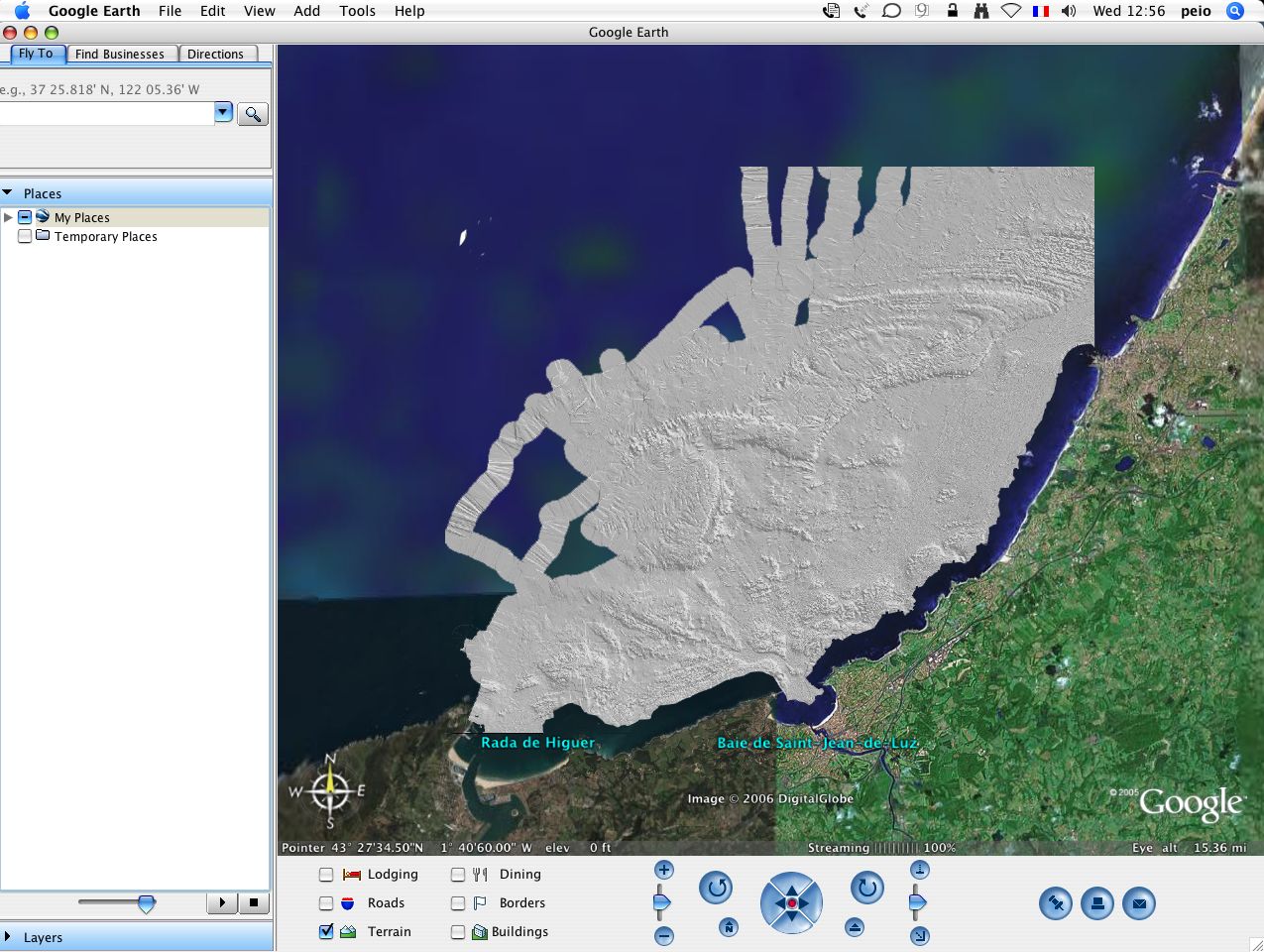
- sun-illuminated DTM: Open this Placemark
- depth contours (isobaths): Open this Placemark
Note : MIS has developed some georeferencing tools for Olex screenshots and for Olex user data. If you are an Olex user, you can get the Ruter2kml converter allowing the visualization of your own user data (marks, tracks, routes, lines, areas) in Google Earth
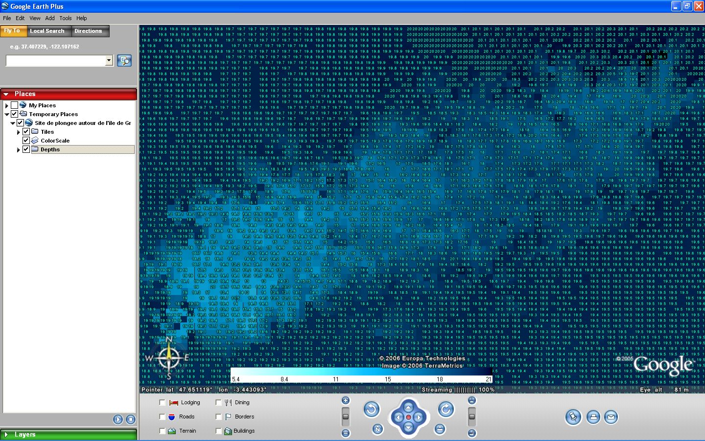
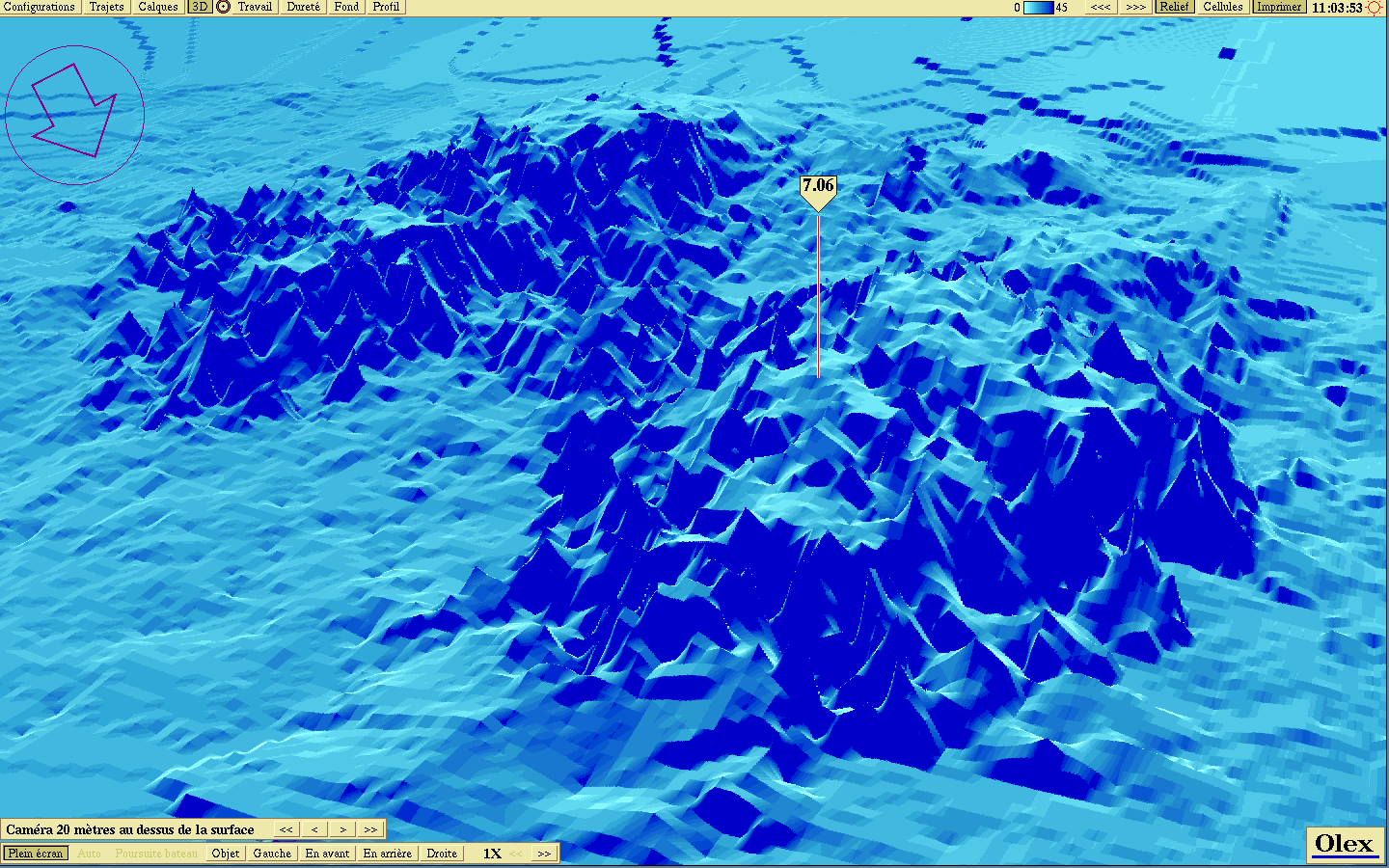
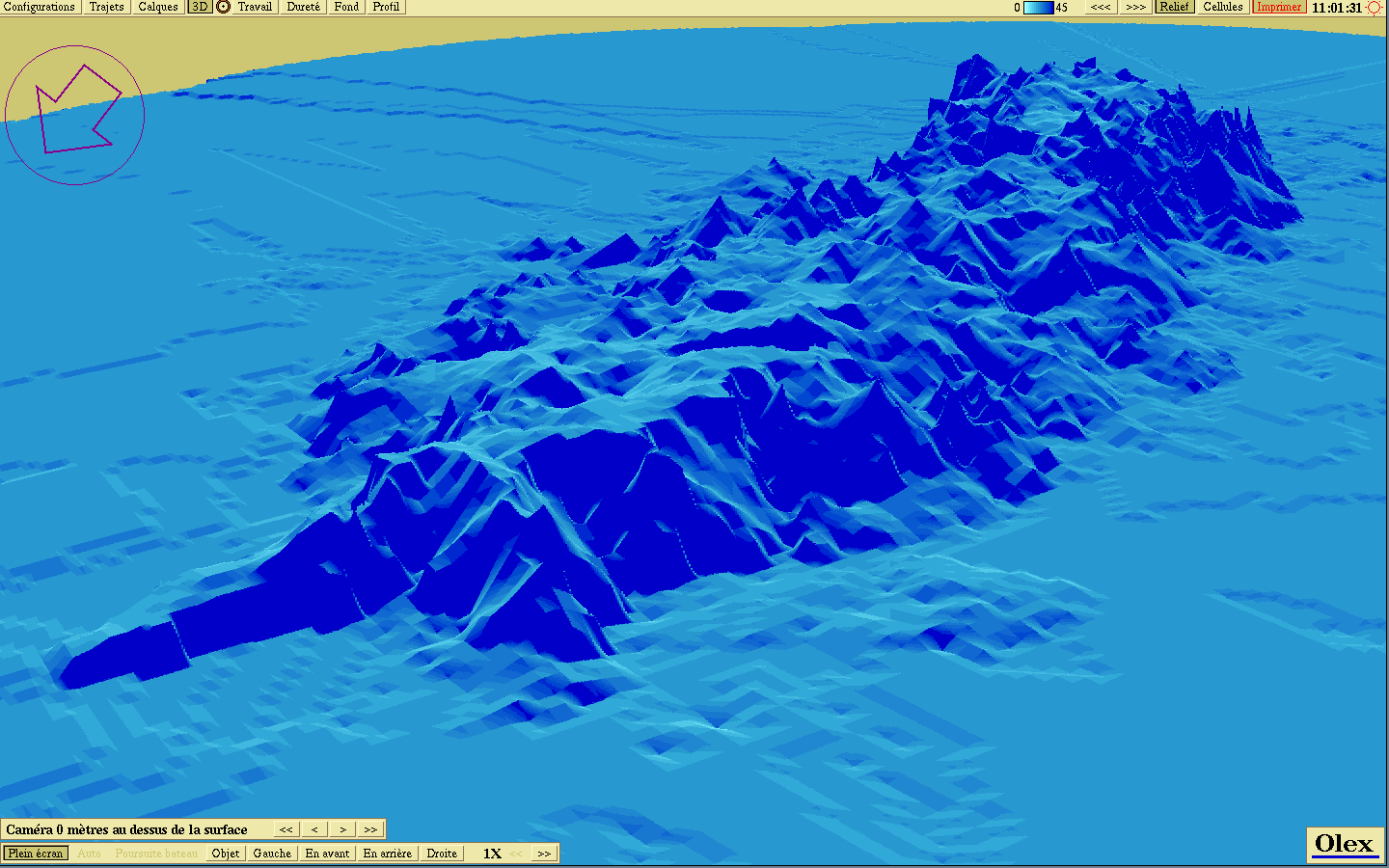
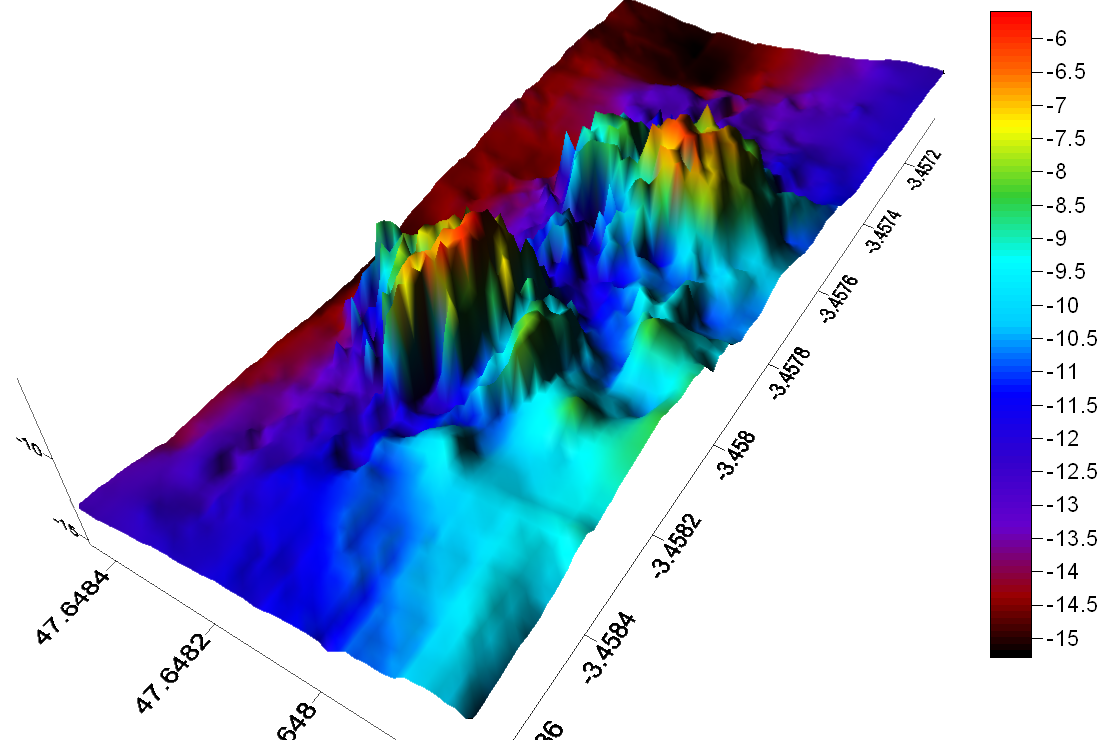
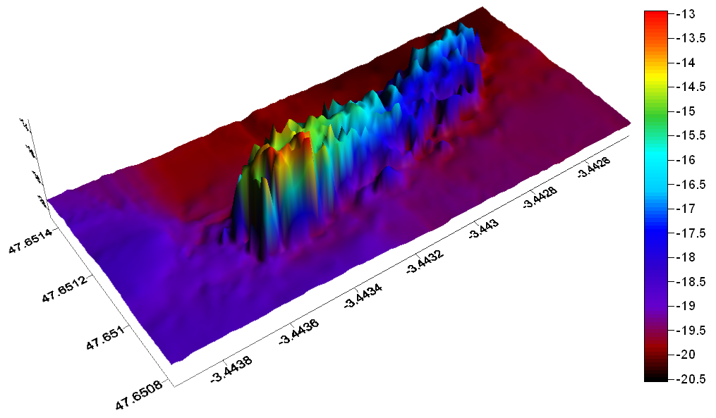
- export data (xyz) from Olex automatic seafloor mapping with color tiles (1mx1m) representing submetric bathymetric cells and depths values from 2 diving sites around Groix island (France) 3D views : Olex (picture1 / picture2) - Surfer (picture1 / picture2) Picture2 : 80m german war shipwreck ‘Sperrbrecher 134 (Argo Rederei)’
9/ Weather
- worldwide clouds overlay : data from xplanet (global cloud map updated every 3 hours using GOES, METEOSAT and GMS satellite imagery downloaded from Geostationary Satellite Imagery page at Dundee University) and compiled by Hari Nair
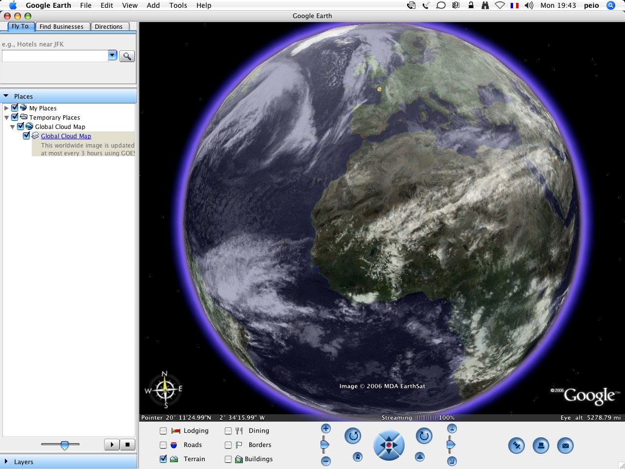
Note : Chris Parsons has improved the process using some Perl+ImageMagick code to to grab the image, copy the same image over the alpha channel and save it as a png : try Global transparent cloud map. He makes it nicer modifying the satellite images to put transparency where there are no clouds (so the Earth comes through clearlier).
- MTSAT and GOES satellite pictures : worldwide daily updated data from Cooperative Institute for Meteorological Satellite Studies (color and B&W Infrared / water vapor)
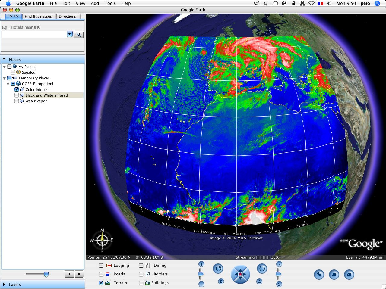
-
GOES 8 Europe Open this Placemark
-
GOES 12 Atlantic Open this Placemark
-
GOES Indian Open this Placemark
-
GOES East Pacific Open this Placemark
-
GOES 10 Eastern South Pacific Open this Placemark
-
MTSAT West Australia Open this Placemark
-
MTSAT East Australia Open this Placemark
-
worldwide Sea Surface Temperature : satellite derived sst data from Space Science and Engineering Center
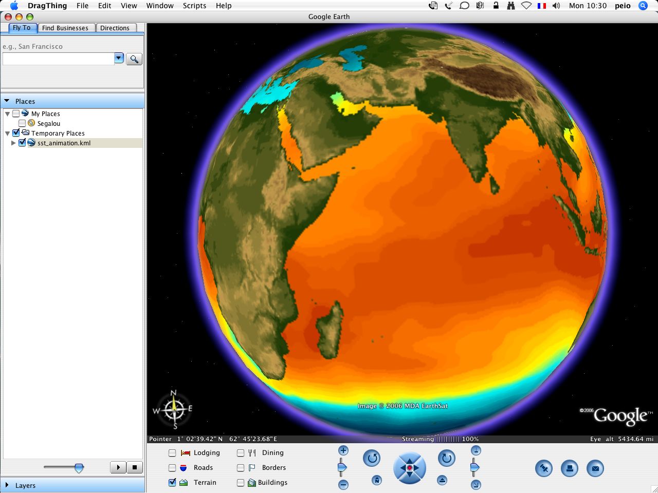
-
daily picture Open this Placemark
-
animation (15 first days in February 2006) Open this Placemark
-
worldwide surf buoys forecasts : surf height from primary swell from stormsurf, a Californian website dedicated to delivering the highest quality marine weather data to those who ride waves. created by Mark Sponsler, a self-taught surf meteorologist and a big wave surfer
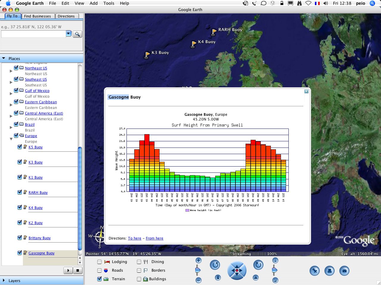
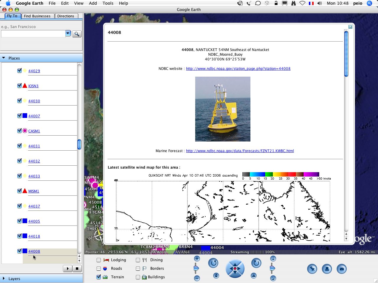
- worldwide weather buoys and stations : from NDBC, US National Buoy Data Center (NOAA) with wind speed, air pressure and other sensors data, latest satellite wind map (QuickSCAT) and SST/Wave Height from Weatherunderground
10/ World Magnetic Declination
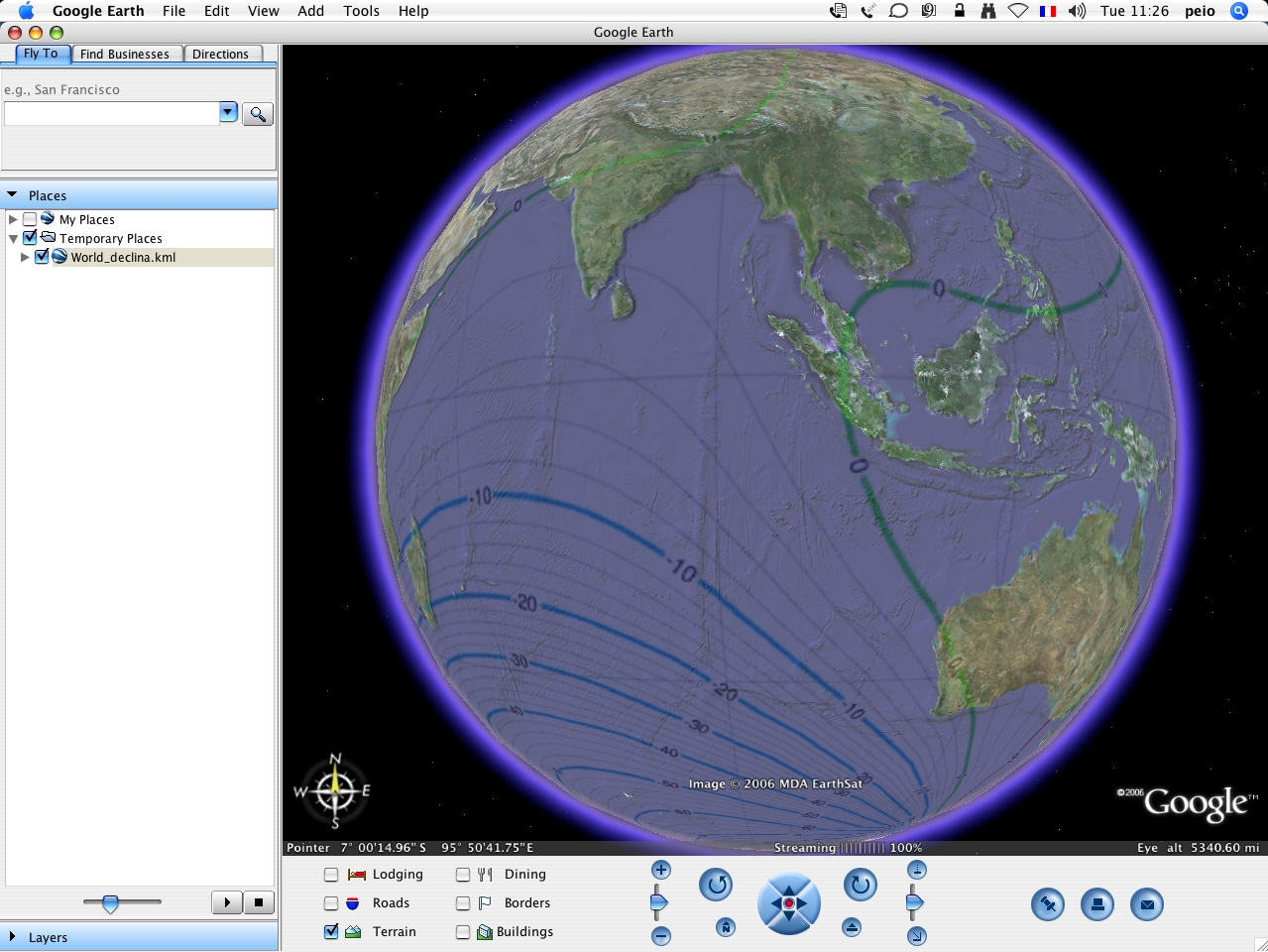
- Main Field Declination (D) : US/UK World Magnetic Model - Epoch 2005.0
11/ AIS vessel tracking
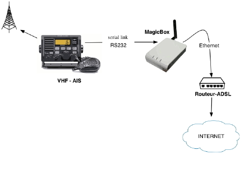
- Live vessel tracking with some AIS/VHF receiver (Icom IF-M505AISN) located in Nantes, automatically sending VDM raw data to our GeoGarage server via a dedicated serial/Ethernet interface connected to some Internet ADSL router (no need of PC).
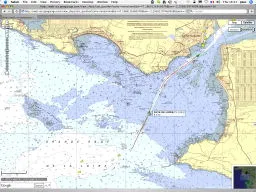
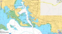
Entrance of the Loire estuaire : Nantes/Saint Nazaire (Google Maps) (Autorization for reproduction n°140/2008 for SHOM nautical maps n°7395 et 7396)
Port Autonome de Guadeloupe: Pointe à Pitre (Google Maps) (Autorization for reproduction n°409/2009 for SHOM nautical maps n°6948, 7100 & 7345)
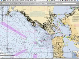
San Francisco harbour with NOAA maps overlay (Google Maps) AIS data, courtesy of John Pettitt
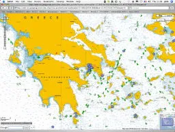
Greece with marine raster map overlay AIS data courtesy of University of the Aegan
12/ Google Maps marine navigation tool : creation of parallel transects for bathymetric surveys
- this tools consits of obtaining parallel profiles across the survey area introducing on the map 2 geographical points (generally perpendicular to the general trend of the shore) and an uniformly-spacing distance between a selected number of profiles
- possibility to save the result in Olex format, kml for Google Earth display or CVS for spreadsheet and to play with a simulation tool to help to manage the reduction of costs involved with echo soundings (calculating ETA on waypoints introducing boat speed for each leg)
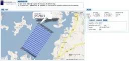
Google Maps mashup : http://gridcoverage.appspot.com/
Note : all theses data have been converted from their original projection and datum to :
- Mercator projection / WGS84 datum for Google Maps
- Plate Carree projection / WGS84 datum for Google Earth.
Other international marine kml/kmz links
Google Tech Talks, December 16, 2008: Google’s Spatial Tools in the Marine Environment Decision Support, presented by Kurt Schwehr (video on YouTube; the video player embedded in the original page is no longer available).
Weather
- Weather stations and buoys
- Near Real-Time buoy data from NOAA - Wind and wave data from buoys
- Buoys - with GM
- iMapWeather Buoys - with GM
- NOAA Florida buoys
- Buoy locations
- Ships and buoys
- Real time NOAA SeaBuoy Meteorology Monitoring [RDEE]
- NOAA Pacific data buoys (World Wind)
- 16 real-time NOAA DART buoys (Deep-ocean Assessment and Reporting of Tsunamis), from National Tsunami Hazard Mitigation Program (NTHMP) (World Wind)
- Partial NDBC Moored Stations
- National Data Buoy Center - with GM
- Buoys and radar weather - with GM
- CORS stations
- Caro-COOPS near real-time ocean weather data
- Windguru coastal weather
- Global Atlantic GRIB wind
- Worldwide GRIB wind
- Worldwide GRIB GFS wind
- Global infrared
- Global Cloud Map - other sources : 1, 2, 3 / 4 (World Wind)
- Global Clouds and NASA Blue Marble / time animation of NASA’s Blue Marble
- live Global Cloud
- 10 days Global Cloud animation
- Global cloud archives (from May 2006 to August 2007)
- Real time Sunlight, Cloud Cover & Low Level Winds
- Clouds - with GM
- Real-time WDSSII (Warning Decision Support System – Integrated Information) Weather Imagery
- Warning Decision Support System – Integrated Information (WDSS-II)
- NOAA NESDIS Satellite Coral Bleaching Monitoring Datasets : Current or Annual SST, SST anomaly, HotSpot, and DHW (twice-weekly, near-real-time, 50-km)
- Latest Global Sea Surface Temperatures - from the Space Science And Engineering Center (SSEC) from the University of Wisconsin-Madison
- NOAA WeatherMole 5 day forecast for any US specific location
- Weather observations map for Australia
- European shipping forecasts
- UK shipping forecasts
- QuickSat wind for Europe
- Wave pattern and height data (South America -SW Atlantic-)
- NE Atlantic Real Time Water Vapour Overlay
- Daily full Caribbean Satellite Imagery - Daily - Sea Surface Temperature (University South Florida)
- Australian weather (METVIS)
- Hurricane live tracker
- Hurricane live tracker (other from Atlantic storms)
- Global Connection Project NOAA Hurricane aftermath aerial photography overlays
- Katrina 2005 hurricane
- Tropical storms
- Storms historical
- CIMSS tropical cyclones
- SAR wind Overlay
- Global Swell Height, Period, Wind & Surf Forecasts from Wavewatch
- ECMWF winds and pressure (World Wind)
- Water temperature Northsea Netherlands
- Hurricane Katrina animation (see collection of GE animations from NASA)
- hourly updated weather readings from ships participating in the NOAA/WMO Voluntary Observing Ship (VOS) program courtesy of destinsharks.com
- VOS (Voluntary Observing Ship) NOAA
- Meteo Consult world meteo spots
- hourly updated meteo sat from Geostationary Operational Environmental Satellite GOES11 / GOES 12
- Ships and buoys weather observations
- TRMM (Tropical Rainfall Measuring Mission)
- Weather for Europe in GM or in GE
- Meteo radar for Switzerland and Italy
- Ships & buoys data for Tropical areas
- Tropical areas
- Hurricane archive
- Hurricane tracker (Virtual Earth) courtesy of Stamen Design
- Marine & Coastal Weather Conditions
- Atlantic Tropical Storm Tracker
- Climate changes forecast
- Hurricane Ike Shoreline Assessment from Texas General Land Office
- Sea Surface Temperature, Sea Surface Winds & NOAA Wave Watch III
- Bundle for weather data (Surface, SPC and NWS Convective Watches and Warnings, soundings, radar, satellite, hurricanes. Great Lakes data, Ocean data, fire weather, air quality index, historical Event.)
- USA National Weather Service Enhanced Radar Image
- NOAA NDBC buoys -GM-
- other NOAA NDBC buoys -GM-
- Animated NOAA Ridge single radar -GM-
- National Weather Service Enhaced Radar Images
- NOAA HF Radar National Server and Architecture Project (used to remotely measure ocean surface currents) -GM-
- weather in the Atlantic Ocean (PassageWeather maps)
- Wind and swell for surfing on French Atlantic coast
- UK weather (rainfall, cloud and pressure) provided by MetOffice
- Wind & weather forecasts on Central Europe -GM-
- ESA GlobColour merged products - MERIS, MODIS, SeaWiFS
- Observations and Doppler weather radar for Australia
- Wind forecast 72 H for West Mediterrenean -GM-
- Animation of the measured winds during Katrina, and the associated water level set up
- 2200 MODIS (Moderate Resolution Imaging Spectroradiometer) images
- Wave and wind height and direction predictions for the Mediterranean Sea
- Storm tracker
Oceanography
- NOAA Google Maps API examples
- NOAA Google Earth examples
- IFREMER Coriolis data this month profiles / this month trajectories operational oceanography
- Sea Level (World Wind) for comparing historical oceans’ levels
- Oceanic Physical Properties Layers (World Wind) selection of ocean layers including bathymetry, temperature, salinity, chlorophyll and a few others / other
- Topographical earth (World Wind)
- Near real time oceanographic data -courtesy of Terrenus-
- Map of projected sea level rise effects on Vancouver
- Flood map simulation Flooded land areas with an increase in sea water levels
- Impacts of Sea Level Rise on the California Coast - with GM
- Sea level rise explorer - with GM
- Sea level rise (mapplet) - with GM
- Flood simulation
- Flood simulation (Sochaux, FR)
- World Wide Map of potential flooding and sea level rises
- Global Sea Level Rise Map
- Sea Level Rise Maps for Eastern North America
- New England Sea Level Rise map
- Sea Level Rise and Coastal Flooding Impacts Viewer
- Rising Sea Level Animation
- other Rising Sea Level Animation
- Sea level (World Wind)
- GOES sea surface temperature and MODIS chlorophyll-a for areas of North America and Hawaii
- Great Lakes Sea surface temperature / Wave heights
- East Australian current with image of chlorophyll concentration in the SW Tasman Sea
- ReefBase - Status of the World’s Coral Reefs - other / NOAA Coral Reef Watch / other (World Wind)
- NOAA reef watch (World Wind)
- Magnetic declination (World Wind)
- Earth’s gravitational anomaly from GRACE (Gravity Recovery and Climate Experiment) (World Wind)
- USGS Coastal and Marine Geology Infobank
- USGS archive of Marine Seismic Surveys
- Various marine geoscience data sets
- Aurora mapping / NOAA auroral activity (World Wind)
- World’s Largest Marine Protected Area: Northwestern Hawaiian Islands
- Department of Marine and Coastal Ressources (DMCR) Thailand
- National Marine Sanctuary Geographic Information
- CAROOPS ocean observation data / placemarks
- Location of research stations, research vessels, icebergs, and drift buoys in Antarctic
- Ocean data (GM)
- Gulf coast Hypoxia map (World Wind)
- High and low water levels in France (World Wind)
- Godiva, visualization of ocean forecast and analysis data (GM/GE)
- ESSC Web Map Service for environmental data
- US Tide Predictions for over 4000 coastal locations -courtesy of DestinSharks-
- Southern Chesapeake Bay tides and currents (NOAA)
- US tides and currents (NOAA)
- US tides and weather
- US tides and currents
- Very detailed tide and weather data mashup for all coastal areas around the US - with GM
- TOPAZ sea surface heights, surface temperature and sea ice concentrations for the Arctic Ocean from NERSC Nansen Environmental and Remote Sensing Center (MERSEA European project)
- Sea ice from NSIDC National Snow and Ice Data Center
- Sea Surface Temperature for Great lakes from NOAA GLERL
- Polarview
- Daily NASA MODIS Satellite Imagery : Terra / Aqua
- MODIS Sea surface temperature
- MODIS chlorophyll concentration
- Sea Surface Temperature from TRMM (Tropical Rainfall Measuring Mission), NASA / JAXA project
- Oceanic Physical Properties Layers WorldWind
- Aqua AMSR-E (Advanced Microwave Scanning Radiometer - EOS)
- ENVISAT ASAR 3-day mosaics, ASAR (Advanced Synthetic Aperture Radar)
- Ice Drift, ENVISAT ASAR
- Drift buoys, Arctic and Antarctic Research Institute (AARI)
- Icebergs, Scatterometer Climate Record Pathfinder (SCP)
- Argo profiling floats
- Argo Ocean Sensor Floats (global array of 3,000 free-drifting profiling floats that measures the temperature and salinity of the upper 2000 m of the ocean)
- JCOMMOPS, official and real-time Argo array (update every 12 hours, 6 and 18 UTC)
- JCOMMOPS, official Argo array of inactive floats (includes trajectories and many links to data centres)
- 3538 ocean characteristics, NGDC/NOAA
- AST sonar image overlays from the HabCam (Habitat Mapping Camera System) survey
- Medspiration, high-resolution Sea Surface Temperature from Envisat & Meteosat 8 satellite sensors
- NOAA/CO-OPS ODIN (Observational Data Interactive Navigation) tides
- Sea Breeze & Sea Level, large and comprehensive compilation of 600 HR maps depicting many properties and processes that govern the behaviour of the world’oceans and seas -for WorldWind-
- Buoys info -courtesy of The Boaters-
- Buoys & weather info -courtesy of Buoy Weather-
- NDBC buoys -courtesy of EarthNC-
- A tool to monitor and forecast local surf conditions with buoy data
- West Coast sites (California and Washington) tides
- Tides for USA -GM-
- Marine Life Protection Act Initiative (MLPAI), Marine Science Institute, University of California, Santa Barbara
- Integrated Ocean Drilling Program
- OBIS provides global geo-referenced information on marine species
- sliders deployment from Rutgers Coastal Ocean Observation Lab (MARCOOS, Mid-Atlantic Regional Coastal Ocean Observing System)
- Real-time and baseline data for future decision-making in coastal management -OpenLayers-
- daily SST for West Mediterranean from SAIDIN (SAtellite Image Database INterface)
- Sea bottom sample repository in Spain (ICM Marine Geology)-Google Maps-
- ICM Marine Geology seismic surveys
- AVISO altimetry
- Integrated ocean observing system
- Harbor View, GLOS Great Lakes Observation System
- Huron-to-Erie Corridor Flows
- National HF radar network surface currents from CORDC Coastal Observing Research & Development Center
- SCCOOS surface currents from Southern California Ocean Observing System
- Animation of water movement during a tidal cycle in an estuary
- Florida Marine : Quickmaps
- Hydrothermal deep sea vents
- Buoy alarm
- Spinning Globe: Global biosphere in Boreal winter as seen by SeaWiFS
- GOOS, Global Ocean Observing System
- Tide jauges
Marine biology and environment
- Fish Mapper maps the locations of 2428 fish species of your auquarium tank
- Underwater orca sounds map
- Invasive Marine Species of Hawai‘i (Bishop Museum and the Hawai‘i DLNR DAR)
- OBIS-SeaMap marine mammals species map
- Oceans of garbage
- Exploring America’ocean realms
- West coast ecosystem-GM-
- California Marine protected areas
- Fish and Wildlife Research Institute
- Ten marine reserves to protect our ocean planet
- a network of marine reserves to save the Mediterranean
- Bathing water quality (EEA European Environment Agency) -Microsoft Virtual Earth-
- NOAA Coastal Studies, Information & Data for the Ecosystem
- Global for marine conservation
- US Coast Guard Environmental Stewardship Efforts
- MPA Marine Protected Areas
- World database on Protected Areas (WDPA)
- Submerged Aquatic Vegetation (SAV) in Chesapeake Bay and Delmarva Peninsula Coastal Bays
- Census of Marine Life Project Map
- NOAA Coral Reef Watch Satellite Bleaching Thermal Stress Area
- Fish and Wildlife Research Institute (Marine Resources Geographic Information System (MRGIS) Internet Map Server (IMS)
- UK Marine Protected Areas
- Permanent Service for Mean Sea Level (PSMSL) tide gauges
Shipwrecks
- Word War II US Navy submarine wrecks
- Shipwrecks
- Zebull shipwrecks French shipwrecks, courtesy of ZEBULL
- Scubadata shipwrecks French shipwrecks, courtesy of SCUBADATA-with GM-
- French shipwrecks, courtesy of A.N.G.E.S association -GM-
- Bermuda treasure shipwrecks courtesy of CERESM
- Shipwreck and submarine world map
- AWOIS US shipwreck database
- NOAA AWOIS database : over 6,400 shipwrecks and over 7,000 other obstructions found in coastal US waterways, contained in the ‘Automated Wreck and Obstruction Information System’ (AWOIS) of the NOAA’s Office of Coast Survey
- NOAA AWOIS database (other source from DestinSharks)
- Visible shipwrecks around the GE
- Sinking animation of how the conditions might have been before the SS Edmund Fitzgerald - a lake freighter - sank suddenly in a gale storm while on Lake Superior
- Sunken vessels in Georgia
- shipwrecks SW England
- Great lakes shipwrecks
- Wreck sites France
3D marine models
- Chicago Harbour Light House
- Needles lighthouse (coast of the Isle of Wight , England)
- Panama Canal
- Grosse Point Light House, Evanston, Illinois
- BP’s Thunderhorse Oil Rig, Gulf of New Mexico
Aerial photos
- La France vue du Ciel aerial photos of France (GE) / La France vue du ciel (World Wind)
- Earth from -aboveTerre vue du ciel- 405 photos tour from Yann Arthus Bertrand / La Terre vue du Ciel (World Wind)
- Survol de France
- Sea shore pictures from the Presqu’Ile de Crozon (France) in GM
- Bretagne region webcams panoramics and pictures in GM
- SHOM aerial photos (World Wind)
- Lighthouses in New Zealand
- World’s largest collection of low altitude, high-resolution aerial photographs of marinas and marine locations from all over the world on an interactive map
- Photos of marinas
- California Coastal Records Project, an aerial photographic survey of the California Coastline
Marine maps
- HSA Systems - navigation mark databases and management, GPS tracks, Zones of Confidence areas in Australia
- 95 seas in the world
- US maritime limits (World Wind)
- Narragansett Bay Marine layer (USA)
- WaCOOL , a joint NASA/NOAA regional oceanographic data center project (navigational chart / CODAAC region )
- NGA Prototype Global Shoreline for Western Pacific Ocean
- Exclusive economic zones
- Maritime boundaries for Inland Seas
- Raster chart 18400 Straits of Geogia and Juan de Fuca -Virtual Earth-
- Torrevieja Nautical Map
- EarthNC Marine Charts about 600 NOAA ENC® vector charts covering US coastal waters courtesy of destinsharks.com, -chart features the same elements (buoys, channels, lights, etc.) found in the original ENC files-
- Quickly find pending NOAA nautical chart changes
- NOAA BSB/KAP raster maps, USA EarthNC Chart Viewer -GM-
- NOAA BSB/KAP raster maps, USA / ChartViewport (other server) -GM-
- NOAA BSB/KAP raster maps, USA ActiveCaptain X Preview -GM-
- Collection of high resolution maps for WorldWind application depicting a wide array of oceanic characteristics and properties. Data categories include Bathymetry, Seafloor Features, Geology, Geophysics, Oceanography and Meteorology
- Italian maps
- Nautical maps from AHS, Australian Hydrographic Service
- Census of Marine Life projects map
- CHS (Canadian Hydrographic Service) nautical charts catalogue
- Explore the Great Barrier Reef Marine Park
- Submarine cables from Kodiak Kenaï Cable Company in Alaska
- WMS raster nautical charts for Norway
- US Marine Protected Areas (MPAs)
- Undersea cables
Bathymetry
- USGS high resolution bathymetry North / South / East (Gulf of Mexico, Florida Shelf)
- Global seafloor bathymetry and land topography synthesis
- NASA blue image
- Relief overlay (with oceans)
- Lake Michigan depth map
- Great Lakes bathymetry / other from NOAA
- Bottom Lake Tahoe
- Leech Lake bathymetry isobaths northern Minnesota
- ArcView Lake Bathymetric Surface courtesy of Joey P. Wade
- Lake Superior collection of image overlays and a bathymetric vector contour of the area where the wreckage of the SS Edmund Fitzgerald was found
- SCCOOS (South California Coastal Ocean Observing System) bathymetry data
- U.S. Estuarine bathymetric data sets / St Andrews
- NOAA estuarine bathymetry
- An Expedition to the Seafloor - Using GE and Ocean Cores to analyze seafloor spreading
- Bathymetric map of Puget Sound
- Bathymetric map of Hawaiian islands
- Seafloor off San Diego, California
- Multibeam bathymetry from Irish National Seabed Survey
- Irish Seabed data from the Irish National Seabed Survey (INSS) and INFOMAR (INtegrated mapping FOr the sustainable development of Ireland’s MArine Resource) programmes / other from GSI
- Bathymetry Florida Shelf Habitat (FLaSH) Map Project by USGS
- Bathymetry (Kattegat North, Denmark) by FRV
- Bathymetry (Kattegat South, Denmark) by FRV
- Bathymetry (Bornholm, Denmark) by FRV
- Bathymetry (Nordsoe, Denmark) by FRV
- La Jolla & Scripps Canyons bathymetry
- Puget Sound bathymetry -GM-
- OBIS-SeaMap -GM-
- Civil Hydrography Programm (MCA Maritime and Coastguard Agency -UK Hydro office-)
- La Jolla Canyon Divers Map
- Lippmann shallow survey
- Golfe du Lion bathymetry (Ifremer)
- shaded-relief image of ETOPO1, 1 minute global relief grid, NGDC
- STRM30+ v.5.0 from Sandwell Lab digital grided data (used in Google Earth v.5)
- Bathymetry in New York -GM-
- ETOPO1 Global relief
- Bathymetric map of San Francisco
- Seafloor mapping of Catalano-Baleares area (Spain)
- Marine GeoScience Data System
- IBCAO International Bathymetric Chart of the Artic Ocean
- NOAA : bathymetry data viewer
- SOEST Main Hawaiian Island Multibeam Synthesis -GM-
- SOEST Main Hawaiian Island Multibeam Synthesis -GE-
- Bathymetry North of New Zealand
- Bathymetry of the entire Dutch coast
- Blue Marble next generation imagery (NASA)
- Bathymetry Data for the Sacramento-San Joaquin Delta
- Hi-resolutions bathymetry sites
- Multibeam Bathymetry for Canada
- Seamounts worldwide map
- Bathymetry for Google Maps
- Arctic bathymetry
- Great Barrier Reef
- Great Barrier Reef (e-Atlas)
Sidescan sonar images
- side scan sonar overlay of the shipwreck of the Blockship Courbet WW2 courtesy of CERESM
- Little LCT sank over Utah beach June 6th 44, side scan sonar overlay courtesy of CERESM
- Princess Olga shipwreck, side scan sonar image overlay courtesy of CERESM
- Shipwreck of the SS Albertville side scan sonar image overlay courtesy of CERESM
- B17 Boeing Bomber shipwreck, Sonar overlay courtesy of CERESM
- 1692 Shipwrecks of Battle de la Hougue, aerial, overlay & placemarks courtesy of CERESM
- Dday invasion map & allied force shipwrecks by National Geographic. Map overlay courtesy of CERESM
- Lost tanks from DDay, underwater sonar view & images courtesy of CERESM
- Side scan sonar underwater overlay of the french submarine Prairial courtesy of CERESM
- Sydney harbor courtesy of Triton Imaging Inc
- Underwater Airplane Crashsite located between Seattle and Bellevue, WA courtesy of Triton Imaging Inc
Multibeam sonar images
- Unique multibeam sounder overlay of the LSt 523 sank over normandy coast during invasion courtesy of CERESM
- Multiberries WW2 courtesy of CERESM
- Shipwreck of the USS Susan B Anthony, underwater sonar view courtesy of CERESM
- Dday sunken articial harbour multibeam overlay courtesy of CERESM
- Plymouth bathymetry courtesy of Triton Imaging Inc
Vessel tracking (real-time positions of ships)
- Live AIS data for Oslo, Norway -with GM-
- Live AIS data on West Coast of Norway
- Live AIS data for Stavanger, Norway
- Live AIS data for Kristiansand, Norway
- Live AIS data for Aalborg, Denmark, Alesund, Bergen, Stavanger, Aukra, Norway
- Live AIS data for Halden, Norway
- Live AIS data for Tromso, Norway
- Live AIS data for Baltic Sea
- Live AIS data for Stockholm, Sweden
- Live AIS data for Stockholm, Sweden
- Live AIS data for Stockholm, Sweden
- Live AIS data for the bay of Botnia, Sweden/Finland
- Live AIS data for Ockero, Sweden
- Live AIS data for Brofjorden, Sweden
- Live AIS data for Sweden
- Live AIS data for GotlandSweden / other / other
- Live AIS data for Nort-East Sweden & West Finland
- Live AIS data for Finland & Estonia
- Live AIS data for Goteborg/Aalborg, Sweden/Denmark / other
- Live AIS data for Malmö/Copenhagen, Sweden/Denmark
- Live AIS data for Malmö/Copenhagen, Sweden/Denmark
- Live AIS data for Skagen, Denmark / other
- Live AIS data for Frederikshavn, Denmark
- Live AIS data for Hirtshals, Denmark
- Live AIS data for Skagerak, Denmark
- Live AIS data for Aalborg, Denmark
- Live AIS data for Thyboron, Denmark
- Live AIS data for Skagen, Denmark
- Live AIS data for Lolland, Denmark
- AIS web service on GE (Denmark)
- Live AIS data for Kiel, Germany
- Live AIS data for Bremerhaven, Germany
- Live AIS data in Germany, Germany
- Live AIS data for North Sea
- Live AIS data for Rostock Harbour and the Baltic Sea / other source
- AIS live vessel tracking for the Hamburg harbour, Germany
- Live AIS data for Rostock, Germany
- Live AIS data for Isle of Wight and Solent, UK / other / Southampton / Portsmouth / Fawlew Marine Terminal / St Helens Anchorage
- Live AIS data for Isle of Wight, Southampton UK
- Live AIS data for Saltdean, East Sussex UK
- Live AIS data for Humber, UK
- Live AIS data for Yarmouth, UK
- Live AIS data for Harwich Haven Ports, UK
- Live AIS in Liverpool, UK / other
- Live AIS in Harwich/Ipswich, UK
- Live AIS in Channel, UK
- Live AIS in Brighton on England’s south coast, UK
- Live AIS in Solent, UK
- Live AIS in Orkney, Scotland, UK
- Live AIS in Glasgow, Scotland, UK
- Live AIS around Glasgow, Scotland, UK
- Live AIS in Scarborough, Hull, Scotland, UK
- Live AIS data for Rotterdam, Netherlands -with GM- / other source
- Live AIS data for IJmuiden Amsterdam, Netherlands -with GM-
- Live AIS data for Amsterdam, Netherlands / other source
- Live AIS data for Netherlands
- Live AIS data for Netherlands
- Live AIS data for Harlingen, Netherlands
- Live AIS data with DSC, Netherlands
- Live AIS data for Terschelling, Vlieland & Harlingen, Netherlands
- Live AIS data for Netherlands
- Live AIS data for Harlingen, Netherlands
- Live AIS data for Middenlimburg, Netherlands (inland)
- Live AIS data for Zeebrugge, Belgium
- Live AIS data for Westerschelde, Belgium
- Live AIS data for Antwerp, Belgium
- Live AIS data for Gent, Belgium
- Live AIS data for Terneuzen, Belgium
- Live AIS data for Flushing, Belgium
- Live AIS data for Gibraltar, Greece, Harwich Haven UK
- Live AIS data for Ramsgate, Isle of Thanet, Dover, Calais, Dunkirk, Ostend, Antwerp & Zeebrugge UK, France, Belgium
- Live AIS data for the Ligurian Sea, France/Italy
- Live AIS data for Trieste, Italy
- Live AIS data for Malaga, Spain
- Live AIS data for Peñíscola, Spain
- Live AIS data for Gibraltar, Spain
- Live AIS data for Spain & Portugal / other
- Live AIS data for Portugal
- Live AIS data for Madeira, Canary Islands and Azores
- Live AIS data for Athens, Greece
- Live AIS data for Greece islands, Greece
- Live AIS data for Aegean Sea, Greece / other
- Marine Traffic in GE, World
- Live AIS data for Greece, Greece
- Live AIS data from MariWeb IMIS (International Maritime Information Systems), Greece
- Live AIS data for Bulgaria
- Live AIS data for Odessa, Black Sea
- Live AIS data for Pudget Sound/Vancouver, Canada
- Live AIS data for Vancouver, Canada / other
- other Live AIS data for Vancouver, Canada
- Live AIS data for New Foundland, Canada
- Live AIS data for lower Great Lakes, Canada
- Live AIS data for Lake Superior, Canada
- Live AIS data for Great Lakes / Saint Lawrence, Canada
- Live AIS data for Thunder Bay, Canada
- other Live AIS data for Thunder Bay, Ontario, Canada
- Live AIS data outhern Maryland & Chesapeake Bay, USA
- Live AIS data for Chesapeake Bay, USA
- Live AIS data for Fort Lauderdale, Southeast Florida, USA
- Live AIS data for Galveston, Texas , USA -with GM-
- Live AIS data for Galveston, Texas , USA
- Live AIS data for Seattle, USA
- Live AIS data for Seattle -other source-, USA
- Live AIS data for Portland, Oregon, USA
- Live AIS data for Mississippi River, Port Fouchon, Calcasieu River, Port Arthur, Houston-Galveston,, Matagorda Bay, Mobile Bay, Savannah, Charleston, Portland, Alaska, Los Angeles Long Beach, USA
- Recent ship activity on San Francisco Bay -time-lapse display of the last hour of AIS ship-tracking reports-
- Current San Francisco bay ship traffic, USA
- Live AIS in San Francisco from Marine Exchange of the SF Bay Region, USA
- Central & Northern California Ocean Observing System : San Francisco bay ship traffic, USA
- Live AIS in Southern California, USA
- Live AIS data for South East Florida (Boca Raton), USA
- Live AIS for Boca Raton, Florida, USA
- Live AIS data for several US harbours , USA
- Live AIS data for Costa Verde, Brazil
- Live AIS data for East of Australia and New Zealand, Australia
- Live AIS data for Townsville, Australia
- Live AIS data for Australia & New Zealand
- Live AIS data for Auckland, New Zealand
- Live AIS data for Auckland, New Zealand
- HSA Systems ReefView - using Google Earth to monitor vessel traffic and plan pilotage in the Great Barrier Reef-
- Be a marine pilot
- Transatlantic sailing records compared : Jet Services (1990), PlayStation (2001) and OrangeII (2006)
- Oceanographic ships and Antartic bases positions, UTC (Unidad de Tecnologia Marina, Mediterranean Enviromental and Marine Investigation Center (CMIMA))
- Real time cruise ships
- Cruise ship tracking
- Cruise ship trackingNorway
- NOAA ship tracker -with GM-
- Real-time positions of BC Ferries vessels
- IFREMER vessels position report
- JOIDES Resolution oceanographic vessel location (Joint Oceanographic Institutions for Deep Earth Sampling) which participates to IODP (Integrated Ocean Drilling Program)
- Coriolis data (Argo program)
- Argo tracking program
- CODAAC NASA coastal AIS reports
- AIS sites from APRS radio-amateurs
- Ships track with callsign (Winlink 2000 and Yotreps databases)
- Vessel tracks
- Ships track with callsign
- YOTREPS Offshore Reports
- Live AIS river USA
- Global AIS viewer World
- other Global AIS viewer World
- Worldwide vessel finder World
- satellite Inmarsat D+ tracking World
- Ocean explorations (NOAA cruises and missions from 2001)
- DSC ship positions World
- Race tracking with weather data -courtesy of iboat Track-
- Inmarsat C vessel tracking -courtesy of Datema-
- Volvo ocean sailing race tracking
- Sailing race tracking
- Vendee Globe 2008
- Volvo Ocean Race 2008/2009
- OSTAR 2009
- Sea turtle tracking -GM-
- Tracking high tech “messages in a bottle” that are set afloat in the Pacific Ocean
- Clearwater fishing vessels tracking -GM-
- Unmanned mini boats crossing Atlantic
- VOS Voluntary Observation Ship Tracks
- 2 minutes of S-AIS data from SpaceQuest over South Africa
- Coastal observing research and development center AIS viewer
- Maersk fleet live positions
- Portmaps
- AIStracker
Atypical sites
- Exploration of 743 ports throughout the world
- Surf predictions and forecasts for surfing spots across the globe
- World surf spots
- Worlwide surf cameras
- Baltic Sea port services (GM)
- Sharing your wave surfing spots
- Global Ocean news map
- World dive atlas or ScubaMAP
- Dive sites for the Emerald Coast
- World shark attack map
- Greenpeace ocean voyage
- Sailing blogs
- Wrecked WW2 submarines ?
- WW1 uboat ?
- World Submarine Wreck Map
- World Shipwreck Map
- Spanish mediterranean fish farm ?
- 500-meter high wave that swept through Lituya Bay, Alaska, after an earthquake in 1958
- Map your fishing trips with GM : free online fishing diary designed to assist anglers by maintaining a visual database of fishing sessions
- Satellite tracking (GM) / other (World Wind)
- GPS tracking (World Wind)
- Position of 800 satellites including: military, global positioning system (GPS), Globalstar …
- Satellites’ coverage from Goddard Space Center
- Lighthouses in New Zealand, and in USA
- Travels of Odysseus in Greece
- Magellan circumnavigation (World Wind)
- Sahara dust blowing over Canary islands from NASA
- 3D model of the SS Edmund Fitzgerald
- Plotting the shortest theoretical course and tacking times for sailors
- Find high risk areas for modern marine pirates
- Real-time moving 3D modelled Cruiseships
- Whale tracking
- Ships viewed in GE
- Marine Points of Interest (POI) visual database of over 8,000 marinas throughout the United States from the knowledge and experience of a worldwide community of boaters -Yahoo! Maps-
- Harbors and marinas in Quebec
- World marinas
- Underwater Roman village in San Javier, Spain
- Illegal fishing caught
- Shark swimming around Sydney surfers
- Online boating resource for the USA
- The Great Whale Trail follows the migration of humpback whales from the warm tropical waters of the South Pacific
- Maps and contact information for 2,576 ports in 187 countries around the world
- SANDRE French oyster park areas
- Baltic sea harbours
- Ships’collection
- Various boats and ships, mostly military
- route of Joshua Slocum (“Sailing Alone Around the World” book)
- Joshua Slocum and Spray’s footsteps on his epic first-ever solo sail around the world
- Guide including a number of coastal tours created with the Google Earth browser
- Favourite surf beaches in Australia from Mick Franning, 2007 ASP World Title holder
- Google Maps Sailing Directions from the fifteenth century for Christopher Columbus’ voyage from Spain to India.
- A Pudget map of recorded whale sounds
- Bluemapia, boating mobile social network
- DCP fishing spots (La Réunion island)
- Fishing in British Columbia, Canada
- Live piracy in 2008 (International Maritime Bureau from ICC Commercial Crime Services) -GM-
- Piracy spots
- Social network geared towards diving and other subaquatic activities
- Alaska marine debris
- Marine videos of YouTube
- Geo-referenced underwater photographs
- Salish Sea hydrophone network
- Maine Public Boat Facilities
- Marina search -GM-
- Harbour distance table -GM-
- Distance calculator -GM-
- Mapping and distance tools -GM-
- Great circle & rhumb lines
- Right whale sighting advisory system
- Swell maps
- Maps for wave surfing
- Ship simulation of navigation
- Imagine a world without fishing (about overfishing)
- Fishing in Arizona - fishing spots in Arizona
- ’East Coast Fishing and Surfing - US east coast surfing and fishing locations
- MyFishMaps - geotag fish catches with GPS locations
- Fishing Aces - post your favourite fishing spots on Google Maps
- Great locations to go fishing in Russia
- Map your fishing trips - Australian fishing map
- New York Fishing Map - Fishing spots in New York
- 1001 Fishing Spots - US fishing locations
- The Angler’s Atlas - Fishing maps for each US state
- Oil spill cartography (Cedre) -GM-
- Oil spills
- World Ocean Day
- Finding jobs in Hydrography : search and find worldwide hydrographic survey projects and surveyors
- Good UK beach guide from MCS (Marine Conservation Society)
- North Caspian Sea Oil spills radar satellite monitoring
- Sailing race buoys in the Solent in kml
- Best surf spots around the world
Informations
- World Wind version 1.3.4 officially supports a plugin allowing you to import Google Earth’s KML files including not only placemarks, but also the very powerful Google Earth network link. Now virtually all Google Earth files can also be used with World Wind.
- A World Wind version written in the Java computer language that will run on Macintosh and Linux computers has been released in September 2006
By the way, if you need any geospatial skills to display your own information, please don’t hesitate to contact us.
For more information
Technico-commercial service: sales@justmagic.com
Updated : October 2026