Services and development
Around Olex, MIS provides value-added services: custom development, free software, technical advice and, at the time of the former website, equipment rental. For a specific need, contact us.
Custom development
MIS has developed software extensions for Olex that make it possible:
- to modify the Olex input/output driver to connect USB GPS receivers (for example with a Linux driver for a Rojone GPS);
- to interface instruments or sensors without NMEA output (proprietary format), which the original Olex
driver does not handle:
- the Tritech PA500 altimeter;
- the Atlas DESO22 and Reson Navisound 215 echo sounders;
- the Thales 3011 satellite compass;
- the Xsens MTi attitude sensor;
- the iXTrawl Geonet acoustic trawl positioning system;
- the Simrad HPR300P acoustic positioning system;
- the Scanmar trawl geometry and Marelec warp monitoring systems;
- to save to a USB key the user plan (
Ruter.gz) and the screenshots (bilder.zip), instead of the floppy disk originally used by Olex (see the ReadMe of these scripts); - to create a “waterline” (zero-depth bathymetry) outlining the area to be charted, for example a lake or a reservoir with no vector chart;
- to convert Autocad DXF vector charts (topographic plans) to S-57 format (DXF2S57);
- to convert files in GPX (tracks, routes) or Autocad DXF format (pipelines, for example) to the Olex user plan format, called “Ruter” (GPX2Ruter and DXF2Ruter);
- to obtain sub-metre bathymetry, with xyz export in Lambert projection and soundings reduced to the IGN69 datum (via the RAF98 grid), with the convert_logRTK_Olex utility for Windows XP;
- to create in the background a text log file that timestamps the raw values from a kinematic GPS and an echo sounder (latitude, longitude, orthometric height, geoid undulation, GPS signal type, number of satellites, HDOP, depth), in order to correct depth with an RTK (Real Time Kinematic) GPS;
- to link Olex with GeoMovie, to georeference underwater video images taken by a ROV;
- to use a dual-screen Linux configuration, with the Dataview software acquiring, displaying and saving timestamped sensor data on the second screen;
- to track vessels (VTS) with Thales Tracs TDMA VHF transponders;
- to acquire NMEA data on several channels and relay them over the Ethernet network as a UDP broadcast;
- to add to the XTide tidal harmonics file the main and secondary French ports, as well as the gauges of the Lower Congo (DRC), with their offsets from the reference port of Bulabemba;
- to import bathymetric data from various sources or databases (see MaxSea import);
- to import fishing plans created by other on-board software, such as MaxSea or Turbo2000;
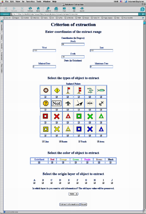
- to create a database of the personal data entered in Olex (example), to extract part of it by geographic area, mark type or dates. The selection interface runs in a web browser.
The list of instruments above was drawn up at the time of the former website; contact us for current equipment.
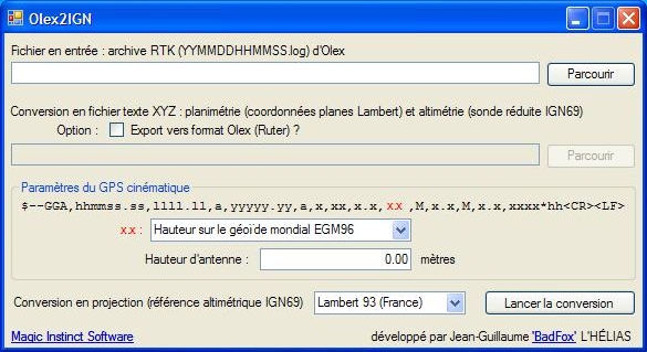 The convert_logRTK_Olex utility
Free software
MIS has published several utilities for experienced Olex users. They are free software, under the GNU GPL 2.0 licence, and their source code can be downloaded below. MIS had them developed as part of a technology watch on cross-platform development tools (Linux, Mac, Windows): they were written by students during their final-year internships.
These utilities are the ones published on the former website: they target the systems of that time (Windows 2000/XP, Mac OS X 10.3, Fedora…).
Olex2GoogleEarth (Ruter2kml)
Cross-platform Perl script (Windows, Linux, Mac OS X), written by a student at EPSI Nantes. It converts the Olex user data (marks, lines, areas from the Ruter file) for display in Google Earth.
Download: Olex2GE.zip.
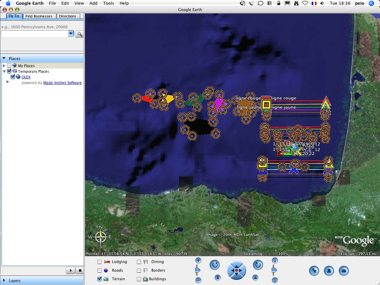 A sample Ruter file in Google Earth
Olex2ArcView (Ruter2shp)
Extension for ArcView 3.x on Windows 2000/XP, written in the Avenue language by a student at EPSI Nantes.
The Olex2ArcView.avx extension converts the Olex user data (marks, lines, areas) into a DBase (.dbf)
table that ArcView can display. The user can then convert it to the standard ArcView shapefile format
(Theme → Convert to Shapefile).
Download: Olex2ArcView.zip, source code: Olex2ArcView_source.zip.
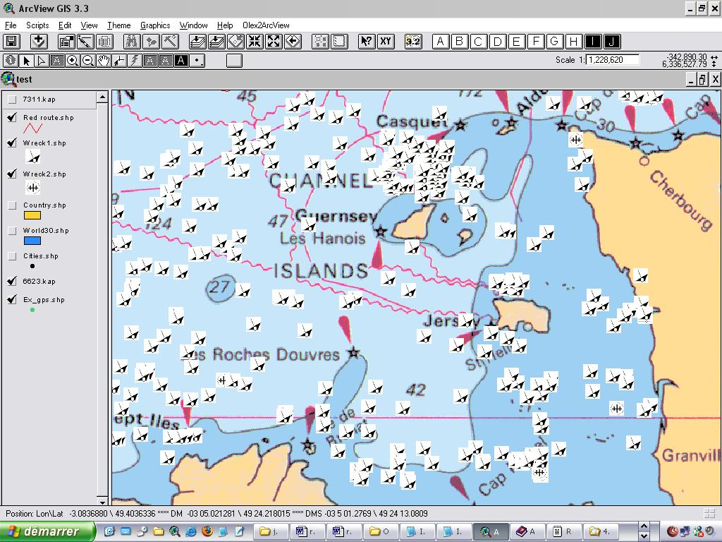 A Ruter file with SHOM wrecks in ArcView 3.3
Olex2MapInfo (Ruter2mif)
Converter for Windows 2000/XP, written by a student at CNAM Nantes. It converts the Olex user data (marks, lines, areas) to the MapInfo MIF/MID format.
Documentation: Olex2MI.pdf, download: Olex2MI.zip, source code: Olex2MI.c.
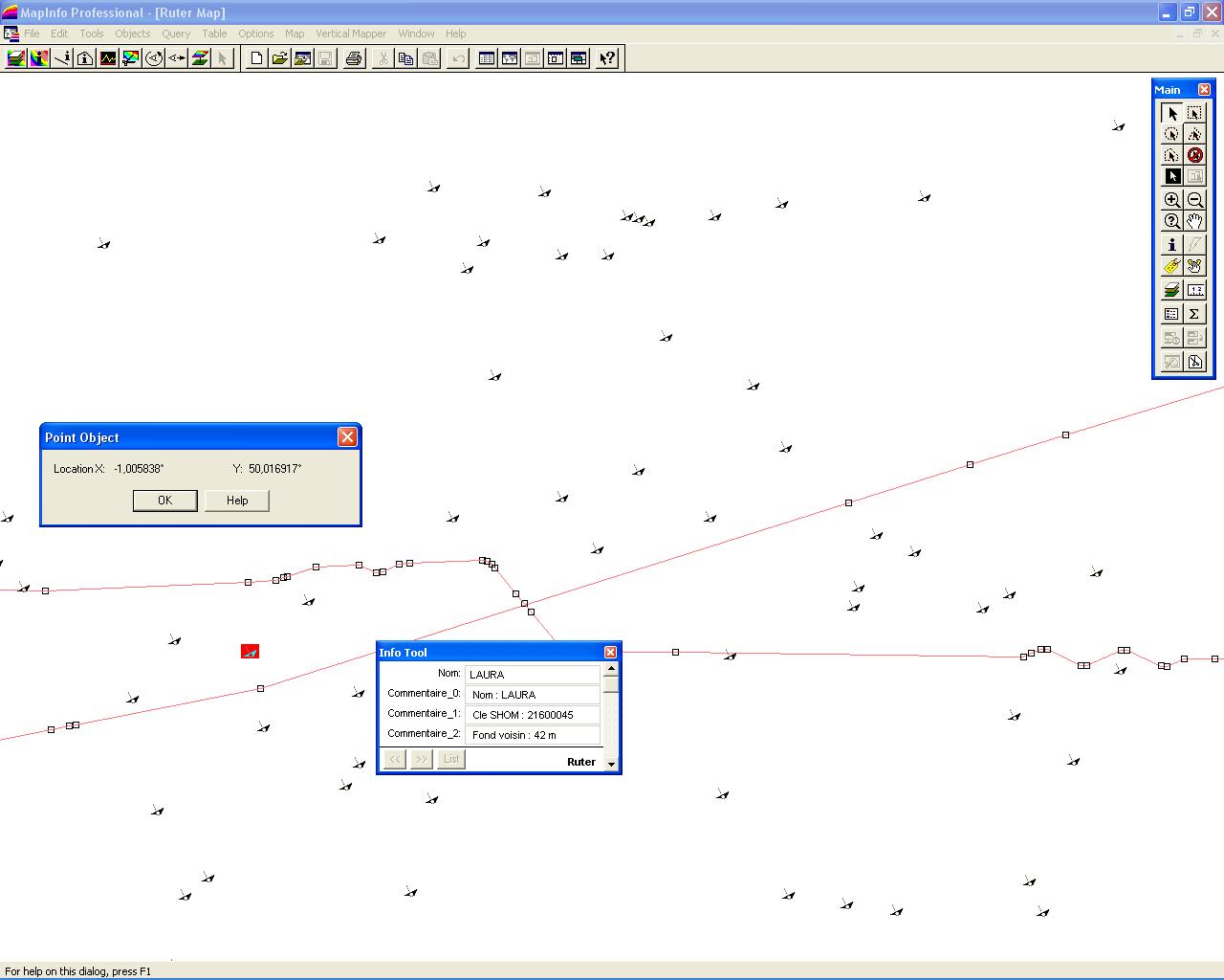 A fishing plan with SHOM wrecks and a submarine cable in MapInfo
GPS2MI
Converter for Windows 2000/XP, written by a student at CNAM Nantes. It displays in the MapInfo GIS the track of a GPS-equipped vehicle, with its heading shown as a vector whose length varies with speed.
Documentation: gps2MI.pdf, download: gps2MI.exe, source code: gps2MI.c.
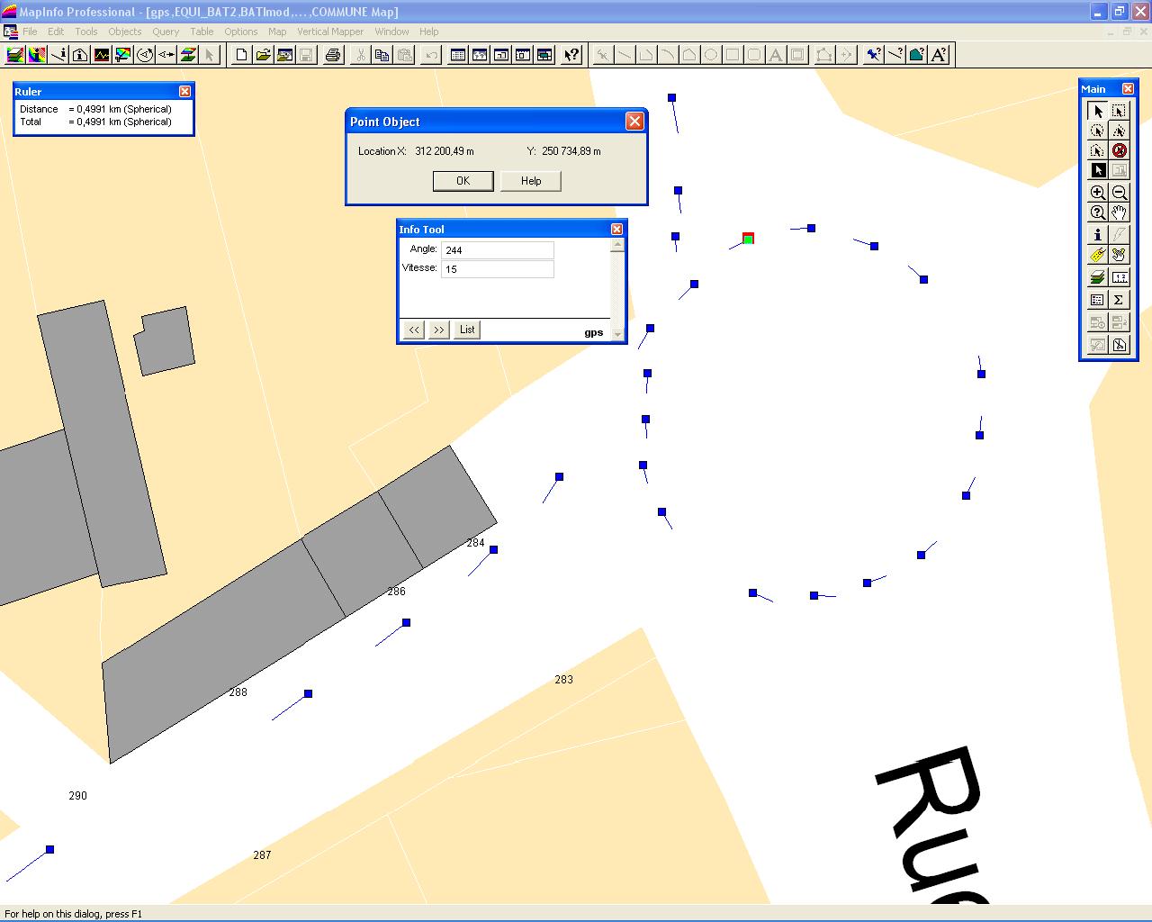 The route of a car in a street in Nantes
Olex2IGN
Cross-platform software (Linux, Windows) using the GTK graphics library, written by a student at EPSI. It converts bathymetric data acquired with Olex (RTK kinematic GPS in WGS84 and echo sounder) into French land survey reference systems: Lambert projection for planimetry and heights referred to the NGF-IGN69 datum.
It works with the Olex Bathy_RTK acquisition module developed by MIS, which records and timestamps the acquired data (date and time, latitude and longitude, depth, ellipsoidal height, number of satellites, GDOP). Olex2IGN then produces an xyz file that can be used in software such as AutoCAD, MapInfo with Vertical Mapper, or Surfer.
Documentation: Olex2IGN.pdf, download (Windows): Olex2IGN.zip, source code: command-line version and DLL.
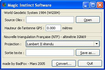 Olex2IGN
Bathy Data Recorder
Cross-platform bathymetric data acquisition software, written in REALbasic by a student at Polytech Nantes. On a PC with two serial ports connected to a GPS and an echo sounder, it records the timestamped and synchronised positions and soundings needed to build a digital terrain model by gridding and contouring.
- NMEA inputs: GGA and ZDA or RMC sentences for the GPS, DBT for the echo sounder.
- Output: xyz text file (date, time, latitude, longitude and depth, separated by tabs), readable by 2D/3D viewers such as Surfer, or importable into Olex.
| System | Download |
|---|---|
| Mac OS 8.6 to 9.x | BDR_Classic.sit |
| Mac OS X 10.3 | BathyRecorder.zip |
| Linux (Red Hat 9, Fedora) | BDR_Linux.gz |
| Windows 2000/XP | BDR.exe.zip |
| REALbasic source code | BDR.rb.sit |
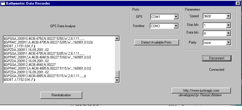 Bathy Data Recorder
Profils_Generation
Cross-platform software written in Java by a student at ESTIA (Bidart). It computes:
- parallel survey lines compatible with Olex, from a geographic point, a heading and a distance (or an existing route segment), with a spacing of M metres, duplication to the left or to the right, and a number N of lines;
- the corresponding route table: waypoint positions, headings, distances, estimated time of arrival (ETA) and time to go (TTG). The user can change the departure date and time, and the stop time at each station.
Download: parallel.jar, source code: parallel.tar, instructions: ReadMe. A Java virtual machine is required.
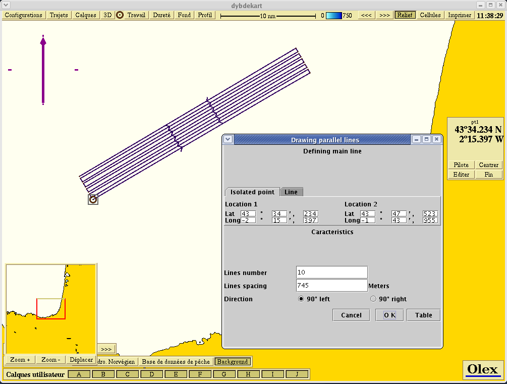 Parallel survey lines displayed in Olex
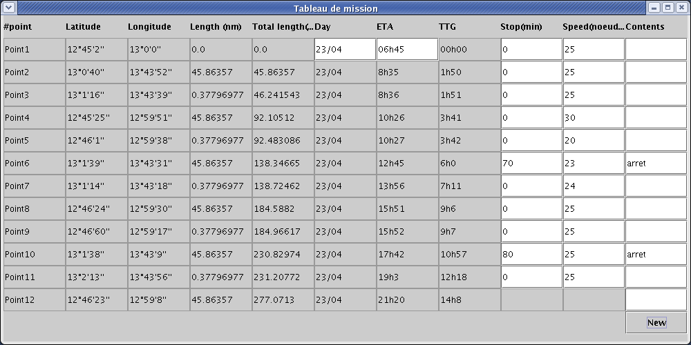 The route table
Magnetic declination
Cross-platform software written in C++ with Trolltech’s Qt library, by a student at CNAM Nantes. It computes the magnetic declination at a geographic position.
Source code: declination.tar. The Qt libraries for the platform (Mac, Windows or Unix) are required.
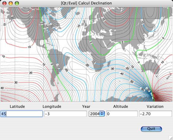 Computing the magnetic declination
Technical advice
MIS advises you on installing Linux and Olex, for example:
- choosing the PC for the intended use, and installing Linux;
- changing the initial configuration, to add interfaces;
- interfacing and setting up Olex with Simrad Ex60 echo sounders over Ethernet.
See also the Installation page.
Equipment and software rental
At the time of the former website, MIS offered a complete lightweight bathymetry system for rent. Its main advantage: it required no particular training, since the bathymetry is built automatically as data are acquired. It included:
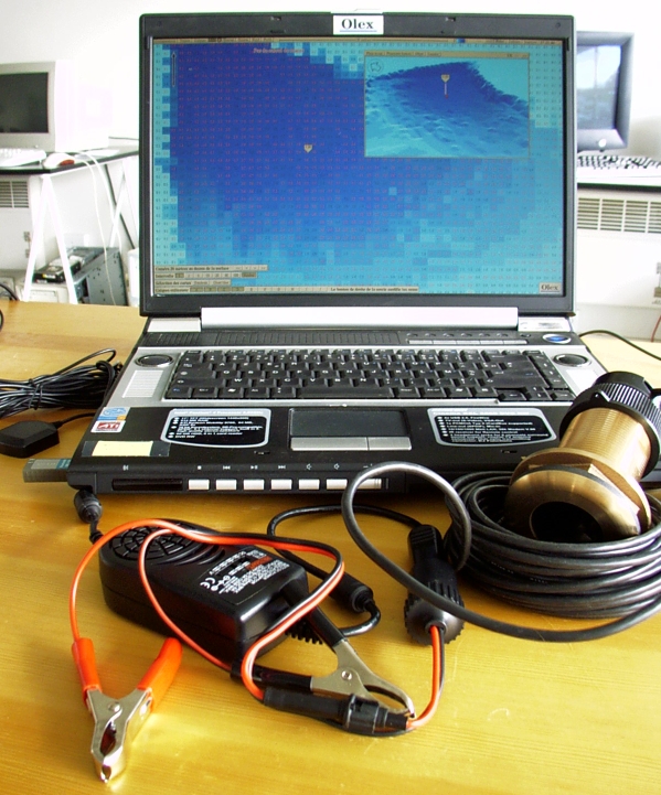
- a laptop (Pentium 4 at 2.8 GHz, 512 MB of RAM, 60 GB disk), supplied with a battery voltage converter (12 V to 20 V), preconfigured with Linux and Olex and fitted with the MIS module for archiving timestamped raw data;
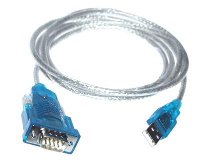
- two USB-to-serial adapters;
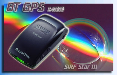
- a Bluetooth SiRF III RoyalTek RBT-2001 active GPS antenna: 12 V supply, SBAS compatible (WAAS and EGNOS), 20 parallel channels, accuracy of 10 m (90%) without correction and 2 m with SBAS;
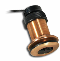
- a bronze Airmar SmartSensor 235 kHz active transducer (SS510): 12 to 24 V supply, 10 m of cable, depth from 0.5 to 100 m, 3 cm resolution;
- a miniature Xsens MTi inertial unit, with a Linux USB driver for Olex developed by MIS, to acquire heading, pitch and roll;
- automatic acquisition of bathymetric measurements, with xyz export of the measurements and of the generated DTM, and conversion to Lambert coordinates with soundings reduced to the IGN69 datum, or to DXF files;
- a module for surveying the waterline when no chart of the water body is available, with the option of creating an Olex base chart in S-57 format from DXF data.
More accurate sensors (sub-metre position, centimetre depth) could also be rented on request:
- kinematic differential GPS: Geneq SXBlue II, Trimble SPS751 RTK;
- precision altimeters: Kongsberg 1007, Tritech PA200 and PA500, Marine Electronics 11001;
- Simrad EK60 echo sounder, with seabed hardness indication.
This equipment list was drawn up at the time of the former website; contact us for current equipment.
Updated : October 2026