Multibeam echo sounders
Olex processes data from a multibeam echo sounder (MBES) in real time. It works as it does with a single-beam echo sounder: the bathymetry builds up on screen, automatically, thanks to an integrated suite of data-cleaning tools. The aim is to handle large volumes of data in a reasonable time: a Simrad EM1002 multibeam, with 111 soundings per ping at 10 Hz, produces about 100 million soundings in 24 hours.
Because it shows the actual survey coverage automatically and in real time, Olex is an ideal quality-control tool, alongside a complete multibeam processing, validation and qualification chain such as those from echo sounder manufacturers or the Caraïbes (Ifremer) and MB-System software.
Beyond bathymetry, Olex anticipated the arrival of fisheries multibeam echo sounders, which improve the detection and identification of demersal and pelagic species.
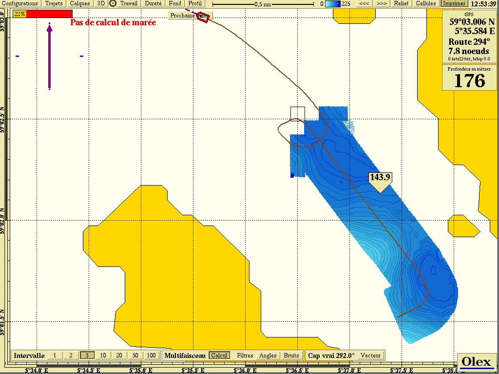 Automatic, real-time 2D/3D construction
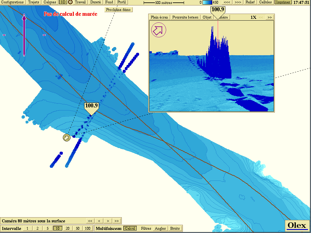 Error checking of multibeam data
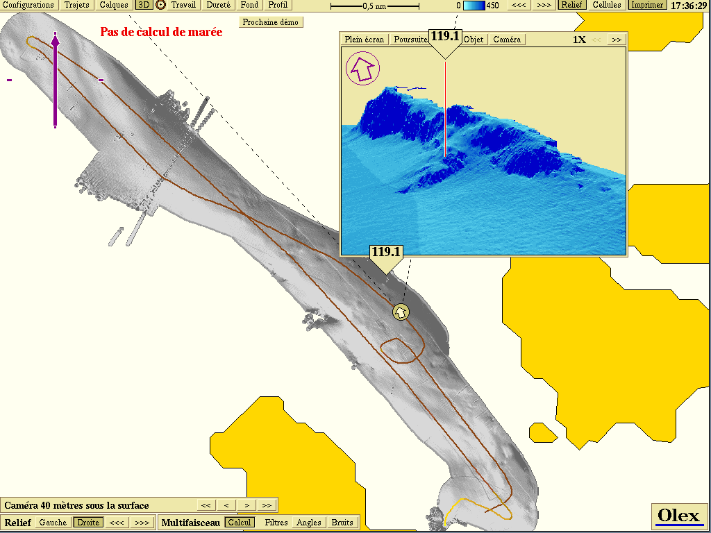 Shaded view and 3D waterfall
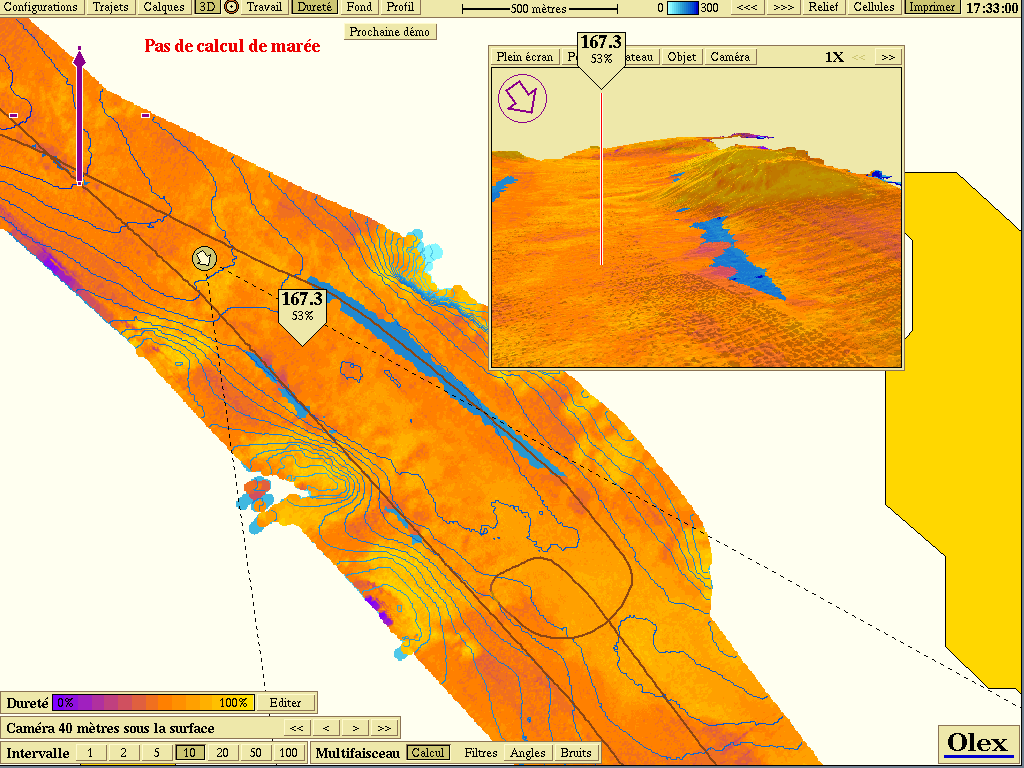 Reflectivity overlay
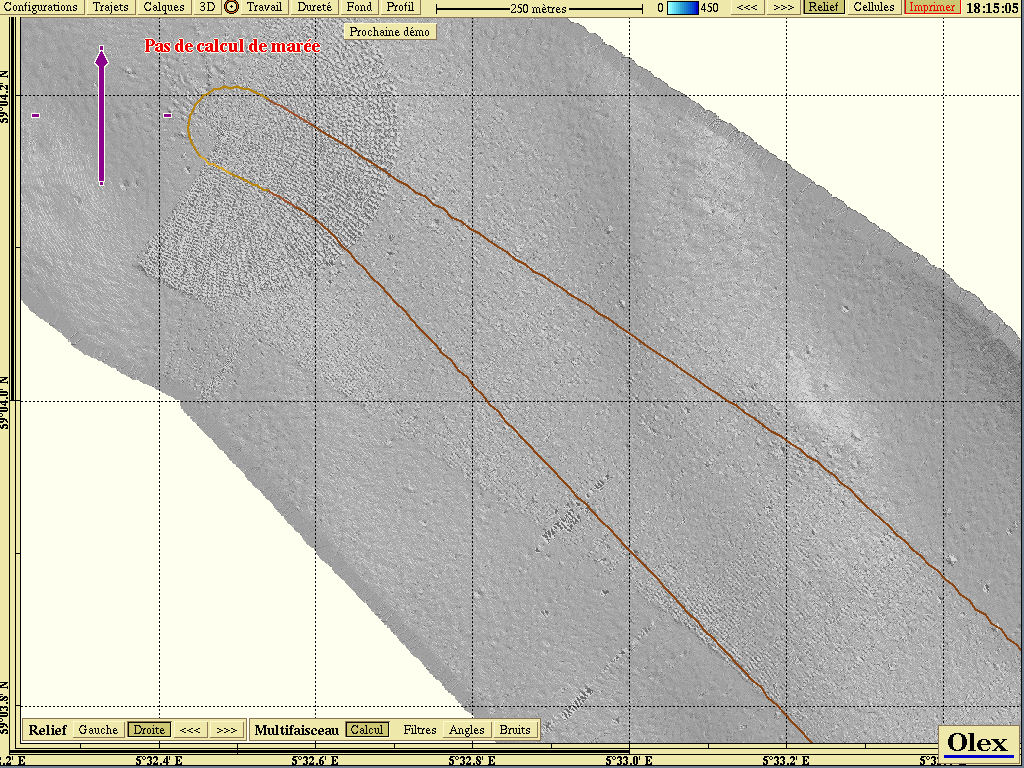 2D relief, shaded view
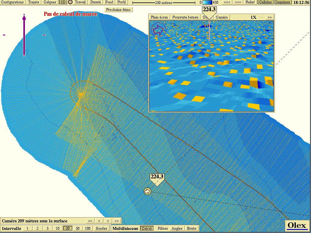 Depth contours and measured cells in 2D and 3D
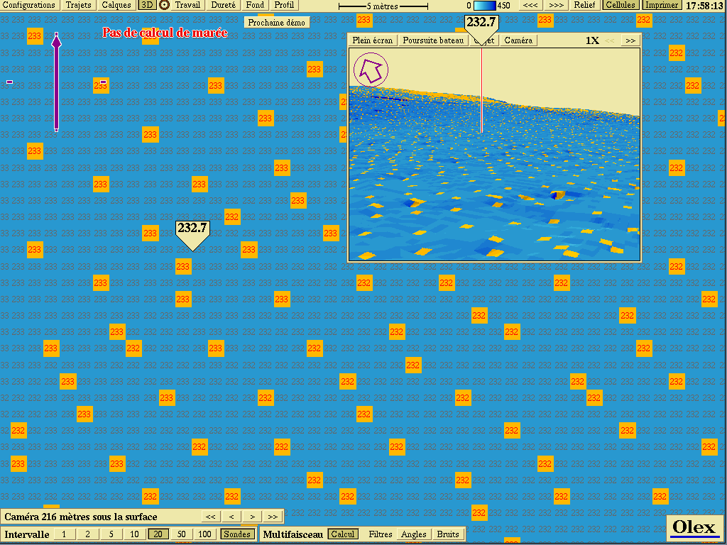 Sub-metre bathymetric cells
Demo movie: Olex MB (QuickTime H.264, .mov).
Functions
- Real-time display of the swath (about 7 times the water depth) for multibeam quality assurance: during acquisition, manual editing of soundings allows a full diagnosis of the processing unit and transducer.
- Automatic filtering and sorting of positions, sounding analysis and correction, tide corrections.
- Display modes, as with single-beam data:
- real-time 2D chart, with depth contours;
- profiles along predefined routes;
- 3D terrain model by interpolation of soundings;
- high-resolution greyscale 2D relief, with several lighting angles.
- Manual and automatic filtering of the digital terrain model (DTM).
- Reflectivity data processing and mosaicking.
- Multibeam data recording.
- xyz export for further processing; xyz import, merging and extraction.
- Screen printing.
- Replay of surveys directly from the multibeam raw data.
Compatible echo sounders
The module is mainly compatible with Kongsberg Simrad and ENL WASSP systems.
Kongsberg Simrad: EM120, EM300, EM1002, EM3000, EM3002, EM3002D, EM710.
| EM300 | EM1002 | EM3002 | |
|---|---|---|---|
| Frequency | 30 kHz | 95 kHz | 300 kHz |
| Depth | 10 to 5,000 m | 5 to 800 m | 0.5 to 300 m |
| Number of beams | 135 | 111 | 127 |
| Beam width | 1° × 1° | 2° × 2° | 1.5° × 1.5° |
When this list was drawn up, Olex was not compatible with other makes of multibeam echo sounders (Reson, for example).
WASSP
Since version 7.4 (January 2008), the Olex multibeam module has been compatible with the WASSP echo sounder from the New Zealand company ENL, designed for commercial fishing and shallow-water surveys. In 2008, the echo sounder cost €19,990, and a complete multibeam survey set-up (laptop with Olex, WASSP and a Furuno SC-30 satellite compass) about €33,500.
The WASSP WMB160F is a wide-angle (120°) sonar at 160 kHz. It analyses the water column and the seabed from 2 to 200 m depth, with a resolution of 15 cm, using 112 beams of 1.07°. It performs two analyses at once:
- bathymetric: morphological and sediment analysis of the seabed over a width of about 3.5 times the water depth, with hardness tools and side-scan functions. Its transducer and signal processing make for accurate, fast bathymetry, with fewer survey lines over a given area;
- fisheries: it detects fish in a much larger volume of water than a conventional single-beam echo sounder and distinguishes aggregations, including close to the seabed. Multibeam, until then reserved for research institutes, becomes available to commercial fishing, for better yields and more selective catches.
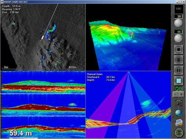 Four-way split display
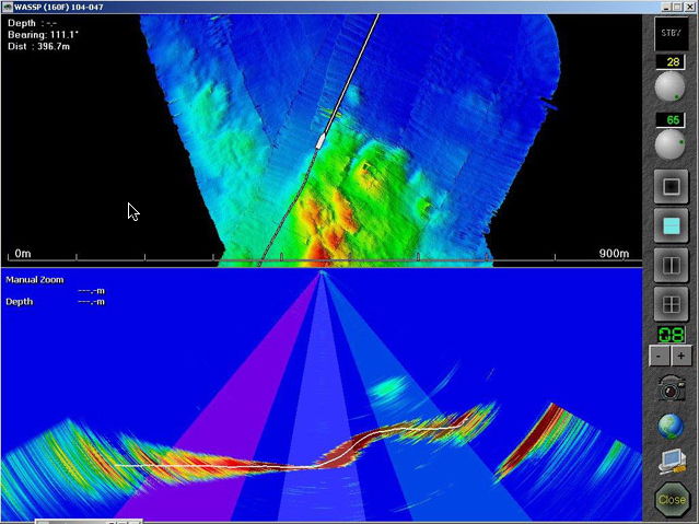 Two-way split, horizontal
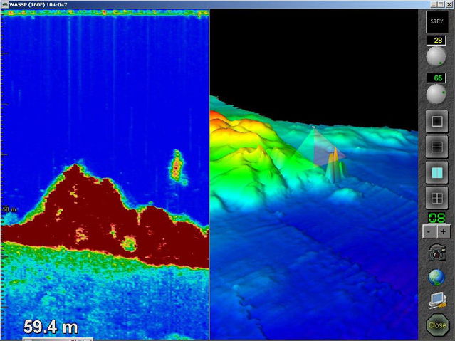 Two-way split, vertical
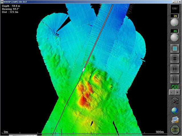 Side scan, 2D view
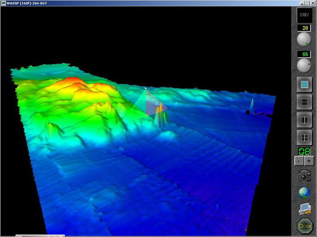 Side scan, 3D view (images courtesy of ENL)
Compatible sensors to improve the system’s performance (roll, and partly pitch and heave, with depth correction only): Furuno SC30 and SC50 and JRC JLR-21/31 satellite compasses, CDL MiniSense MEMS attitude sensor, Applanix POS MV V4 inertial system (Position & Orientation System for Marine Vessels).
References
Olex multibeam has been used by, among others:
- Blom Maritime (Norway), on the Nordkabel (EM1002 multibeam) and the Bintang (EM3000). Holder of a contract with the Norwegian Hydrographic Service to collect data along the Norwegian coast (Enhanced ENC production project, 2002-2006), Blom used Olex for real-time quality control and visualisation of multibeam data, as well as for planning, route design and cable and pipeline route studies;
- Norwegian Underwater Intervention (NUI), Bergen, on its AUV NUI Explorer fitted with an EM3000;
- the Norwegian military intelligence service, with an EM300;
- the Institute of Marine Research (IMR), Svalex and the University of Bergen, for a geological expedition around Svalbard on the research vessel G.O. Sars, with data from an EM1002 processed in Olex;
- Statoil and some of its subcontractors, to replay archive data;
- the Canadian Hydrographic Service, Halifax, testing with an EM1002;
- RRS James Cook (NERC, Natural Environment Research Council), with EM120 and EM710;
- Aspect Surveys, with an EM3002.
A paper presented at the 2009 GEBCO Science Day describes the Olex global sounding database as a phenomenal resource for regional bathymetric mapping projects.
Other examples of work:
- airborne laser bathymetry (lidar) with Tenix LADS;
- multibeam mapping of coral reefs in Norway;
- bathymetric survey off the west coast of Sweden (Bråten) on board the German research vessel Alkor, with an EM1002 and a SeaBeam 1180;
- mapping of the Mid-Atlantic Ridge between Iceland and the Azores, on board the G.O. Sars, with an EM300.
Updated : October 2026