AIS module
AIS (Automatic Identification System), or AIS transponder, lets shore stations such as the French CROSS identify vessels remotely. It continuously transmits the vessel’s position and course.
Regulatory framework
The European directive of 27 June 2002, which set up a Community vessel traffic monitoring and information system, has been transposed into French law. It requires AIS on all vessels calling at a port in the European Union:
- since 1 July 2002, for new passenger ships of more than 300 gross tons;
- before 1 January 2005, for tankers;
- before 1 July 2007, for all other vessels, new or existing.
Shore-based AIS stations were all to be installed by 2006.
How AIS works
AIS relies on a data communication technique developed in the 1980s, SOTDMA (Self-Organized Time Division Multiple Access). It lets many transmitters share a single narrow-band radio channel by synchronising their transmissions on a precise reference time:
- each minute is divided into 2,250 slots of 26.67 ms; at 9.6 kbit/s, a slot carries 256 bits, enough for an AIS report;
- the exact GPS time synchronises each vessel’s slots, and the GPS of course provides its position;
- on first contact, a vessel takes a free slot and reserves another one for its next transmission, depending on its state. A vessel at 23 knots, reporting every two seconds, thus reserves one slot in 75 (2,250 / 30);
- the range is that of VHF, to the horizon. Each vessel is at the centre of its own communication cell, whose size adapts to traffic density: when free slots run short, the system drops the most distant targets first.
Further reading: AIS on Wikipedia and the US Coast Guard AIS page.
AIS in Olex
Without waiting for the legal requirements, Olex was one of the very first charting systems to offer, from version 2.16 (December 1999), an optional module for AIS transponders.
The equipment lists below were drawn up at the time of the former website; for current equipment, contact us.
Class A (SOLAS vessels, merchant navy): these transponders transmit the vessel’s characteristics, position, draught, cargo and destination. Models listed: Furuno FA150, Saab R4, Northrop Grumman (Sperry Marine) R4, Comar CSA200, Kongsberg AIS200, ACR Electronics GlobalWatch and Nauticast2, JRC JHS-182, MX Marine / Simrad / Navico MX531 and MX535, CNS Systems VDL6000.
Class B (non-SOLAS vessels: fishing vessels, leisure craft over 15 m): ShineMicro RadarPlus AIS-BX and SM162B, SmartRadio SR262, Comar CSB200, SevenStar Electronics SeaTraceR, TrueHeading AIS CTRX, Samyungenc SI-60B, Alltek Marine Camino-101, SmarterTrack AIT250, Transas Class B, Sjeng Jay Automation Tech SJ-8912RT, AWAIS-100, CML Microcircuits DE70321 demonstrator kit, AWAIS for AtoNs, Raymarine AIS500.
Class B is a cheaper version of Class A, with a shorter range, which reports less often (for example every 30 seconds below 14 knots, against every 10 seconds for Class A). It does not transmit:
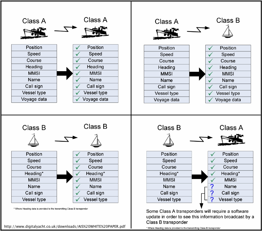
- the vessel’s IMO number or call sign;
- the ETA or destination;
- the navigational status;
- the text of safety messages;
- binary messages;
- the rate of turn;
- the maximum draught.
Olex is also compatible:
- with AIS receivers, for vessel tracking: Furuno FA30, Weatherdock EasyAIS, SeaCAS SafePassage, SmartRadio SR161 and SR162, ShineMicro SM162B, Comar SLR200, Nasa/Sitex, Raymarine AIS250, SevenStar Electronics SeaViewerR, TrueHeading AISRXYacht, Icom RX-AIESGPS and MXA-5000, Samyungenc SI-60RX, Alltek Marine Cypho-101, Kata, AWAIS-200;
- with combined VHF/DSC/AIS radios: Furuno RO4800, Navicom RT-650 DSC, Icom IC-M603 and IC-M505, Garmin VHF-300.
What the module does
Olex automatically displays the vessels identified by AIS on the vector chart. They can appear together with ARPA radar targets, with a different symbol to avoid any confusion. Users follow the movements of surrounding vessels in real time and can plan their route ahead to avoid collisions.
- AIS vessels identified by a label next to their symbol on the chart.
- Table of identified AIS vessels.
- As for ARPA targets: recording of vessel tracks, display of their heading vectors and of their turns to starboard or port.
- Short text messages sent to any nearby vessel fitted with an AIS transponder.
The CROSS can also warn of an obstacle or hazard by placing a virtual aid to navigation (virtual AtoN), broadcast by their AIS station (AIS message 21): no buoy exists on site. As soon as a hazard is reported, the authorities can warn all navigators with an AIS receiver, until a real physical mark is installed.
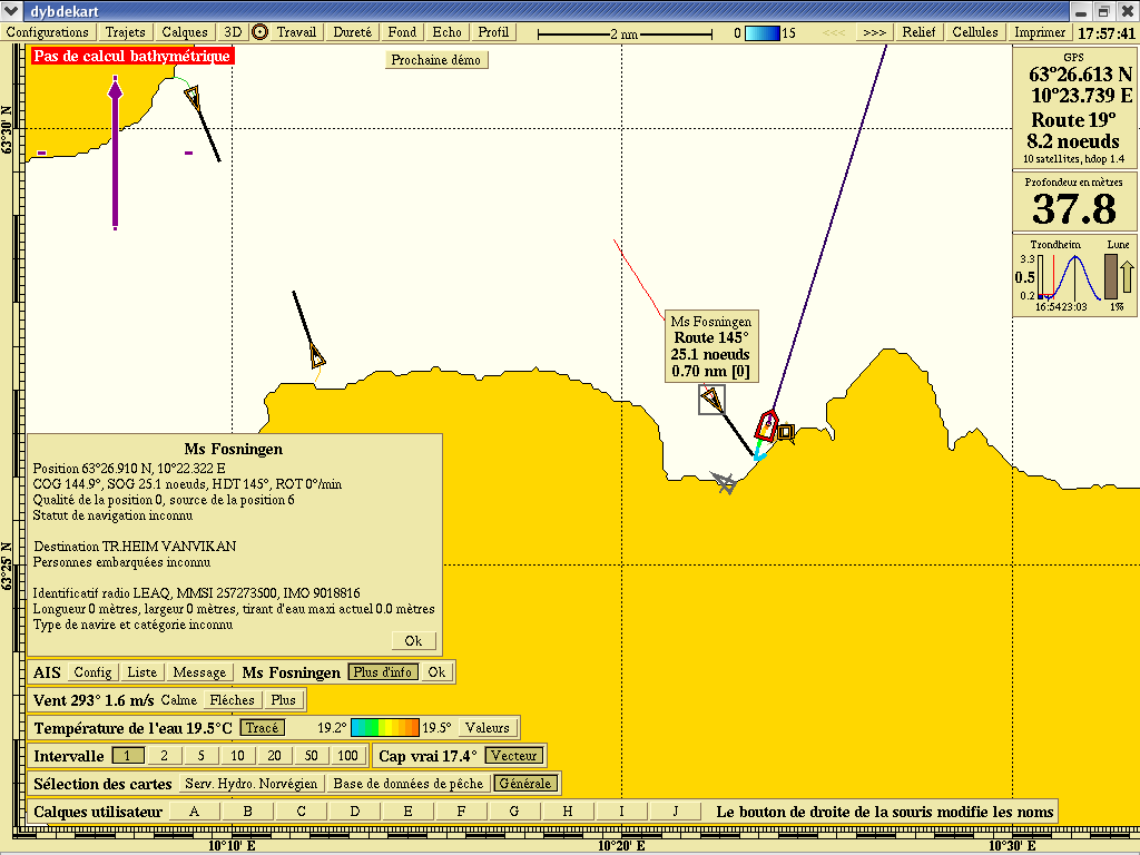 Target details
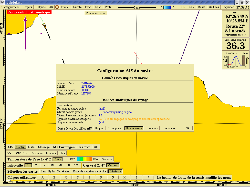 Vessel AIS configuration
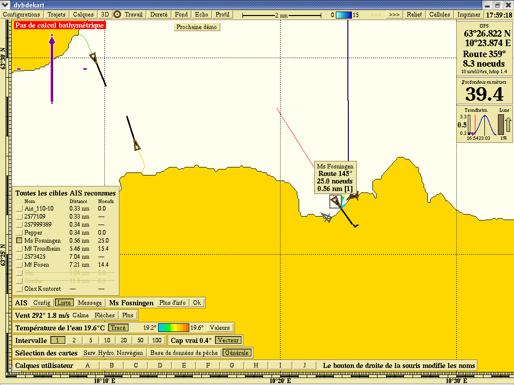 All recognised AIS vessels
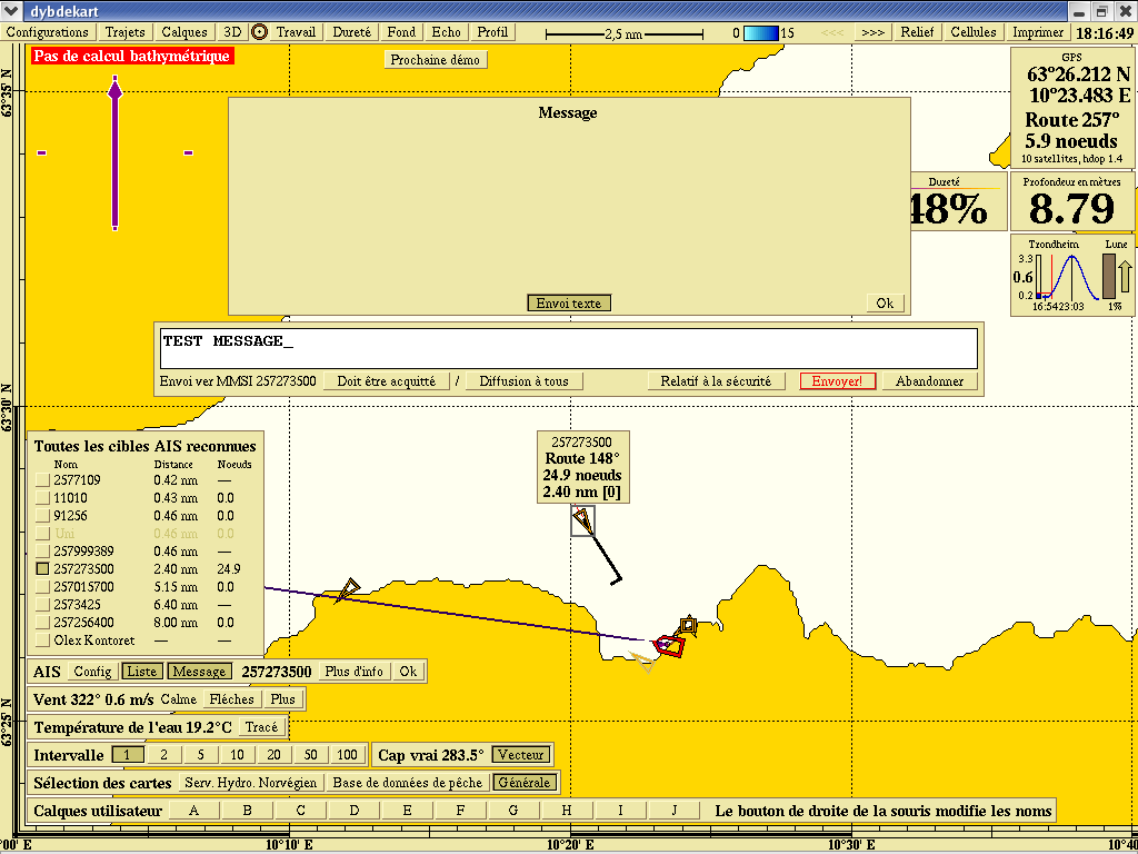 Sending an AIS message to a vessel
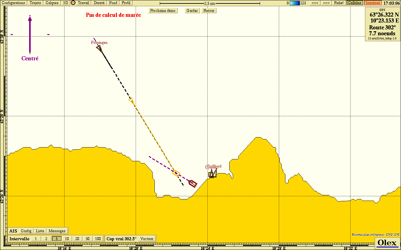 Graphical collision avoidance
The Olex extra: stereo bathymetry
Since version 6.4 (September 2006), the AIS module can build bathymetric maps with the GPS and echo sounder data of a nearby vessel, also fitted with Olex, that shares its information over AIS.
This function, popular with pair trawlers, shows the tracks of both vessels and the bathymetry building up along their route. It also avoids the lengthy computation of exchanging the two vessels’ bathymetric databases.
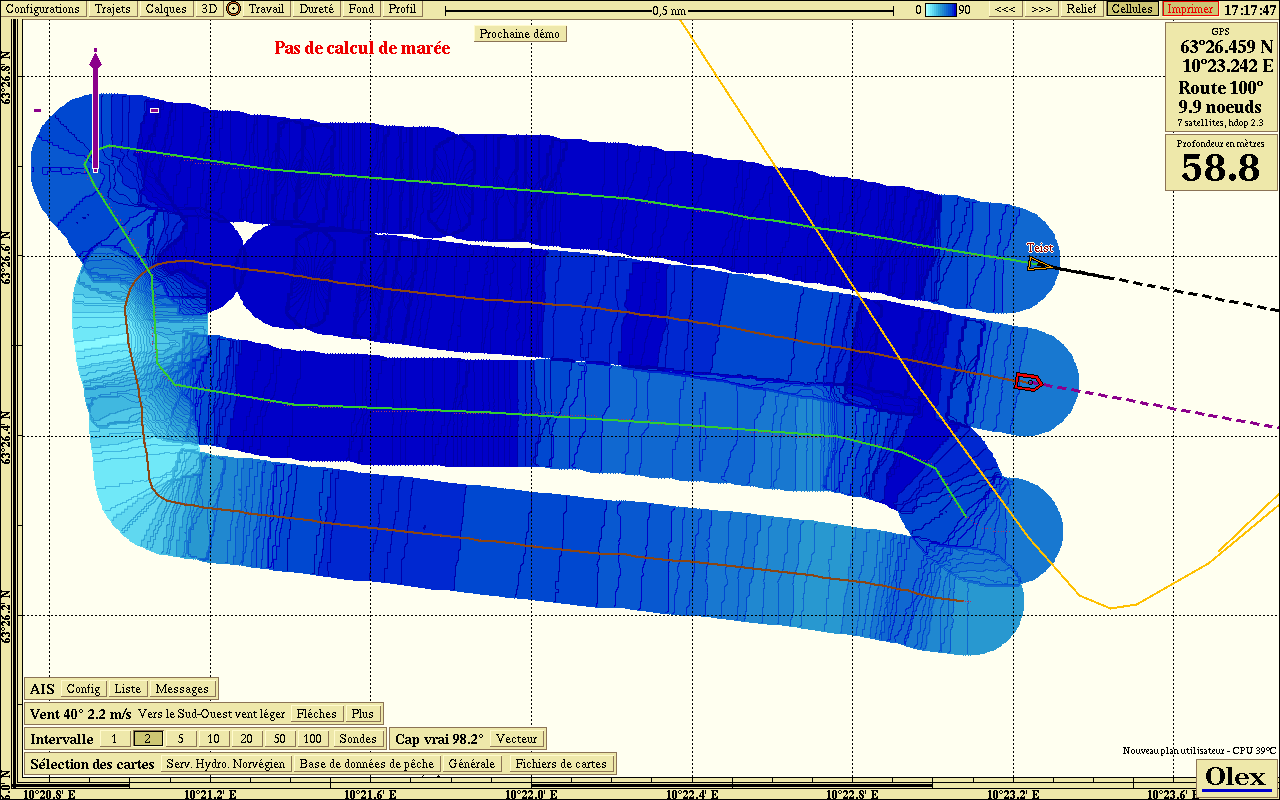 Bathymetry of two pair trawlers via AIS
Updated : October 2026