Features
Olex is a navigation system that generates seabed topography maps from the GPS and the echo sounder. By combining this information with vector charts in S-57 or C-Map CM93 format, it offers 3D navigation.
Vector electronic charts
- Selective display: each type of information (lights, light sectors, names, aids to navigation) sits in a layer that the user shows or hides. Depending on the zoom level, Olex only shows what is useful: every detail at large scales, the essentials when zooming out, to keep the chart readable.
- Dynamic display: when the vessel is inside a light sector, the sector flashes in the light’s colour.
- Chart orientation: north-up, a direction set by hand, or the vessel’s course (Course Up mode). In course-up, the vessel points to the top of the screen and chart labels are redrawn to stay horizontal.
 Light animation (click to play)
An easy-to-use route plotter
- Deliberately simple interface, so that every function can be learned quickly.
- Mouse (or trackball) and function buttons: very few functions are in menus. The keyboard is only needed to type names or comments on the chart.
- Marks, lines, routes and areas in several colours, created in a few clicks.
- Automatic, real-time saving of user data: even after a power cut, everything entered is still there.
- Fast display: all information is held in a single file, organised as a multi-level geographic database, for fast selective display according to scale.
- Unlimited memory: Olex keeps all the vessel’s tracks and can redisplay them track by track, year after year. The bathymetric map it builds can cover the whole Earth without saturating the system.
Seabed map generation
- Bathymetry computation that is automatic, real-time and runs in the background.
- The more the vessel sails over an area, the better the seabed representation.
- Soundings from the navigation charts shown in the background are not used in the computation and are not updated by the vessel’s surveys.
- 5 m by 5 m cells.
- Analysis tools for the bathymetric maps:
- 2D relief for an overview;
- surface mode, with depths shown as a colour palette;
- depth contours generated quickly, at the chosen interval (down to 1 m);
- zoom on a sounding line with slope shading, for example to find drop-offs;
- seabed profiles, to locate peaks and hollows and their distance from the vessel;
- 3D view with scales and distances, for an intuitive understanding of the underwater relief.
- Data exchange between users: Olex users can share the bathymetric data they collect, through MIS or directly with each other by import and export.
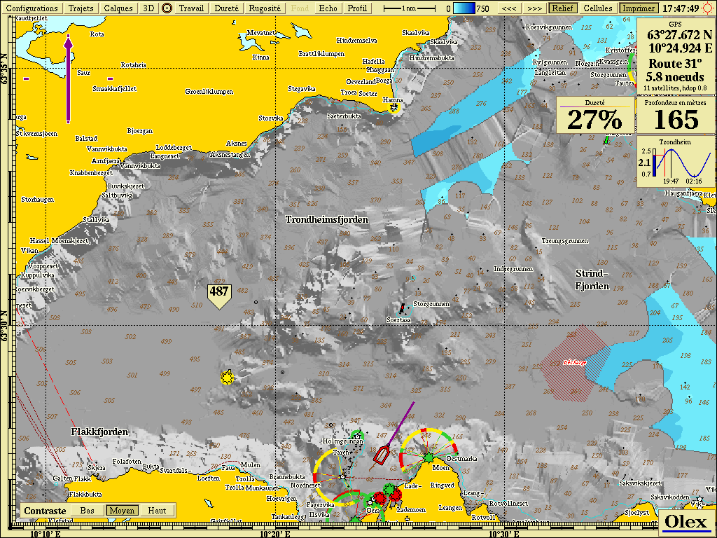 2D view, relief mode
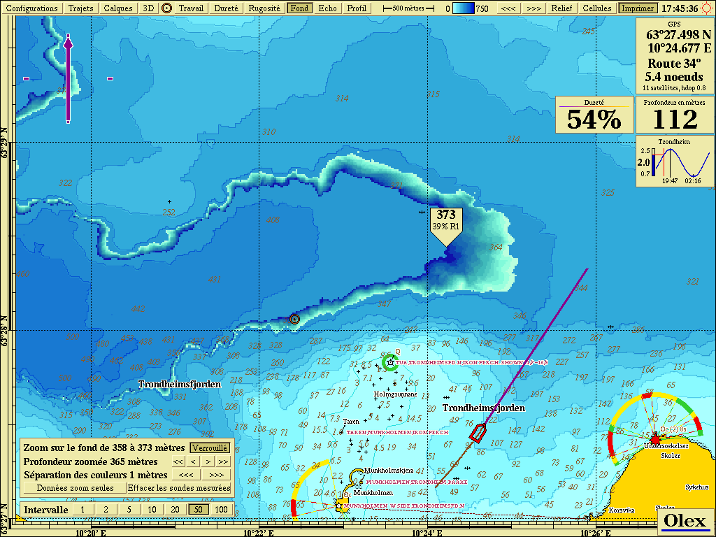 2D view, slope shading mode
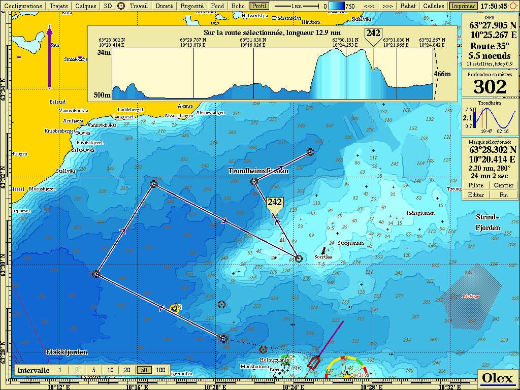 2D view, seabed profile mode
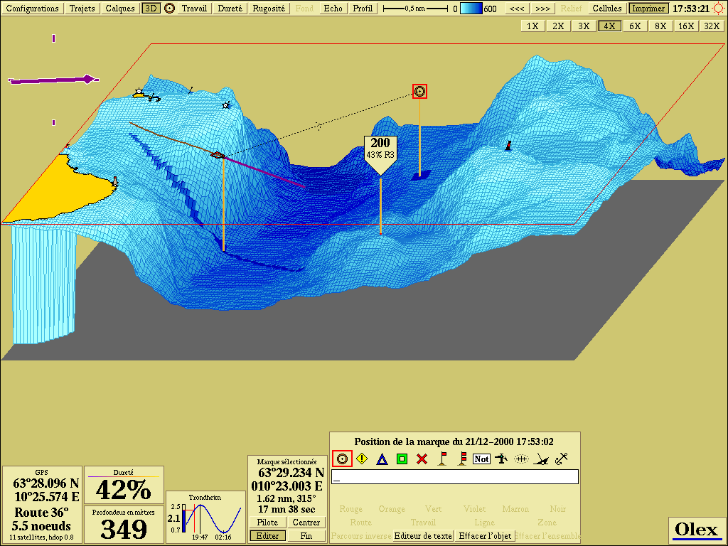 3D view
Updated : October 2026