Charts
Olex only uses vector digital nautical charts. It is not compatible with scanned (raster) charts.
Yes raster is faster, but raster is vaster, and vector just seems more correcter. (Tomlin, 1990)
Olex’s internal format
Olex stores charts in its own archive format, a SENC (System Electronic Navigational Chart), that is, its own chart database. Vector chart formats, including the IHO S-57 standard for the exchange of digital hydrographic data, were designed to distribute data, not to display and use it efficiently on screen. Olex therefore converts each imported chart into its SENC.
Charts supplied by MIS
Since December 2021, MIS has been an official Primar distributor of S-63 ENCs for its Olex customers. ENC cells are sold as an annual subscription, weekly updates included: quote on request, contact us.
Official S-57 ENCs
Since May 2003 (version 5), Olex reads official data in S-57 format, a topological vector format, produced and kept up to date under the control of national hydrographic offices.
Olex is an ECS, not an ECDIS
Olex displays and uses ENCs, real-time position, heading and speed data from the navigation sensors, and ENC updates. However:
- it does not automatically handle the alarms and indicators that warn of a problem with the displayed information or of equipment malfunction;
- it does not strictly follow the S-52 standard, which defines how charts are drawn on screen (colours,
line styles, area fills, text placement). An ENC is a folder of several files: the database (
.000), its updates (.001,.002…) and text or TIFF image files. Olex does not open a properties window for each object: it shows this information dynamically. A light flashes according to its characteristics, and its colour changes with the vessel’s position in the sector; - for reasons of cost and procedure, Olex AS does not seek ECDIS type approval for its system from the certification bodies.
Olex is therefore not an ECDIS compliant with IMO standards and does not replace paper charts on vessels subject to the SOLAS convention (Safety of Life at Sea).
ENC distributors
Several organisations group the ENCs of national hydrographic offices for distribution:
- Primar (Stavanger) was the first to group the ENCs of the hydrographic offices of Denmark, Estonia, Finland, France, Lithuania, Norway, Poland, Russia, Sweden and Singapore. Since June 2004, Primar has also distributed IC-ENC charts as a value-added reseller, for a catalogue of 2,100 charts at the time.
- IC-ENC is a Regional ENC Coordinating Centre (RENC), following the IHO’s Worldwide ENC Database (WEND) model. It grouped the ENCs of Belgium, Cyprus, Germany, Egypt, Spain, Greece, India, the Netherlands, Portugal, South Africa, Sri Lanka and the United Kingdom.
- The JHA (Japan Hydrographic Association) supplies the charts published by the Japan Coast Guard.
- NOAA’s Office of Coast Survey, in the United States: see also the public data that can be loaded into Olex.
SHOM had by then produced about a hundred ENCs, covering the coast from Dunkirk to Nantes and the Mediterranean coast, including Corsica (April 2007 catalogue).
Around 2007, an evolution of the S-57 standard, provisionally called S-100 and based on a GML-type grammar, was being finalised. Hydrographic offices then planned to keep producing and distributing ENCs in S-57 format, or encrypted in S-63 format, at least until 2012.
History: C-Map CM93 charts
Olex originally read C-Map vector charts in CM93 Edition 2 format (CM93/2). Produced by a private company, without the control of a hydrographic office, they are not ENCs in the IHO sense and do not replace paper charts. They were nevertheless approved by DNV (Det Norske Veritas) and offered the largest worldwide catalogue of vector charts. CM93 charts are divided into zones, regions and cells of 4° by 4°; mainland France falls in zones 1 and 2.
In July 2003, C-Map stopped distributing CM93/2 and replaced it with CM93 Edition 3 (CM93/3), better protected against copying. C-Map did not provide integrators with a Linux library to read this format, and imposed how charts were handled in the software (its own SENC), which did not fit the Olex developers’ approach. Yet the ECDIS standard leaves each manufacturer free to choose its internal format. In MIS’s view, the CM93/3 SENC was becoming a proprietary exchange format competing with the official S-57 and S-63 formats. In early 2006, SHOM nevertheless approved the distribution of its ENCs in C-Map’s SENC format.
MIS therefore stopped offering C-Map CM93 charts to new customers. It obtained from C-Map that Olex customers who already owned CM93/2 charts, and only they, could update them by subscription or buy new ones.
In early 2007, C-Map was bought by Boeing and joined its Jeppesen Marine division, in response to the UKHO’s purchase of SevenCs. Jeppesen also ran Nobeltec, which used the Passport chart catalogue (Transas charts).
History: Chartworld charts
Chartworld, a German company based in Hamburg and founded by the creators of SevenCs, signed a partnership with Navionics, a competitor of C-Map, at the end of 2001 to produce and distribute its charts in S-57 format. In January 2004, Navionics Chartworld charts replaced C-Map CM93 charts for Olex. Published by a private company, they are not official ENCs, but they are distributed in the IHO S-63 format, which encrypts the data (Blowfish algorithm) to protect it against piracy.
At the end of March 2004, the S-63x standard was launched to standardise the packaging and distribution of ENCs, on top of the S-63 and S-57 standards. ENC distributors (UKHO, Transas, Chartworld) and ECDIS manufacturers (HDW-Hagenuk, Raytheon Marine, SAM Electronics, SevenCs, Sperry Marine, Transas) agreed to implement it.
Notes:
- in early 2006, the UKHO bought SevenCs and Chartworld;
- Chartworld was also a value-added reseller of official ENCs from IC-ENC and NOAA;
- since Olex uses its own SENC, charts are imported with a user permit supplied with the software licence;
- the proprietary formats directENC from SevenCs and TX97 from Transas are not compatible with Olex;
- Olex version 5 or later is required to read these charts;
- charts and permits were supplied as
.zipfiles, to be burned to CD-ROM for installation; - Navionics Chartworld charts are different from those used in leisure plotters and software (Navionics Gold). They were updated two to three times a year, with monthly updates planned for 2005;
- the purchase price included one year of updates (set in the permit). After that, users kept the last update or bought a new annual permit.
Each Chartworld chart is a folio of charts at several scales, from detailed charts (harbour entrances, 1:10,000) to coastal charts (1:300,000):
| Level | Use | Scale |
|---|---|---|
| 1 | Overview (fewest details) | smaller than 1:1,000,000 |
| 2 | General | 1:300,000 to 1:1,000,000 |
| 3 | Coastal | 1:80,000 to 1:300,000 |
| 4 | Approach | 1:40,000 to 1:80,000 |
| 5 | Harbour | 1:10,000 to 1:40,000 |
| 6 | Berthing (most details) | larger than 1:10,000 |
Chartworld prices from 1 June 2007: €150 excl. VAT per cell, €1,250 excl. VAT per zone.
One harbour, several chart types
The same port, Les Sables-d’Olonne, on the paper chart and in three vector chart sources:
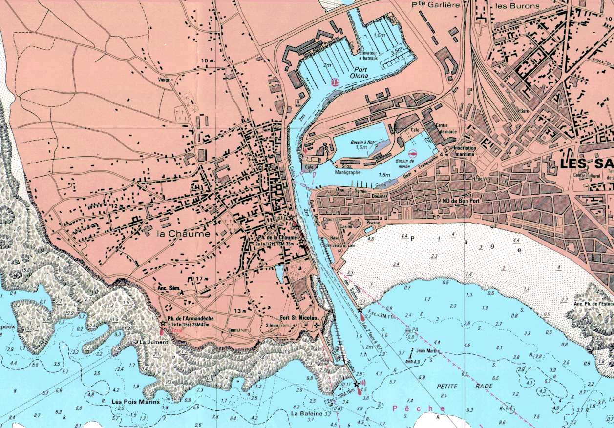 SHOM paper chart 6551
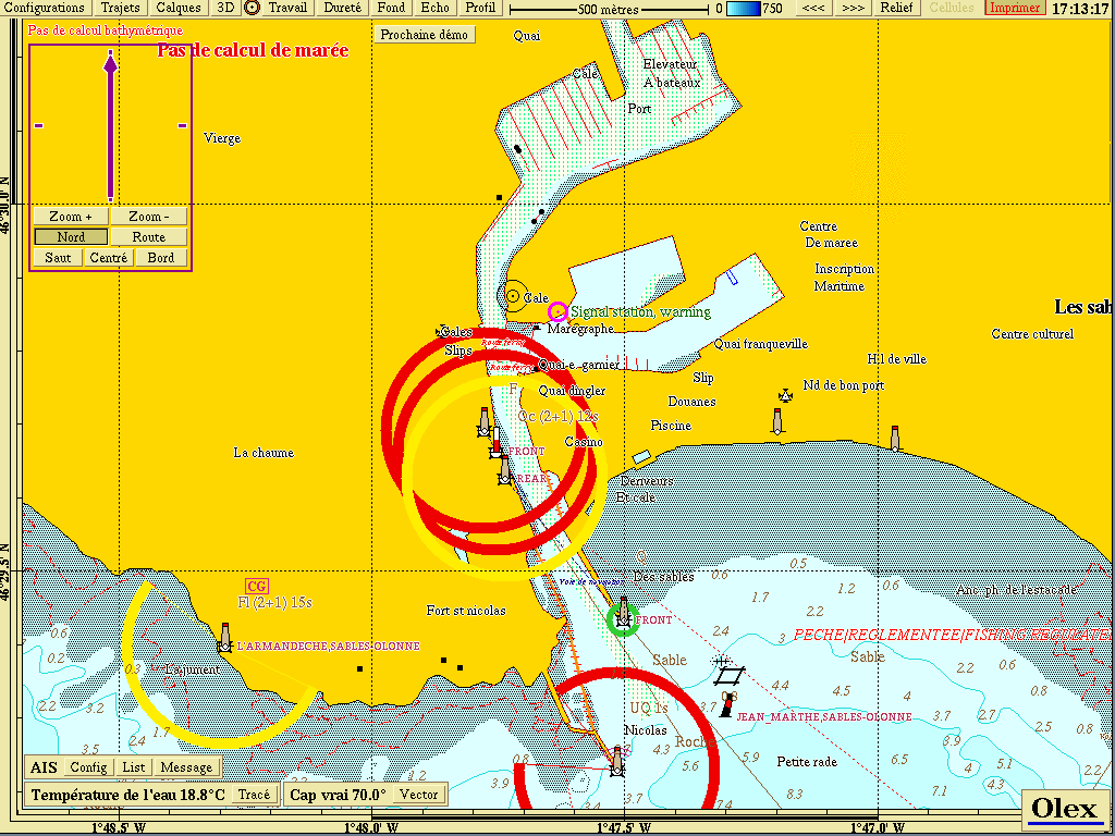 C-Map charts
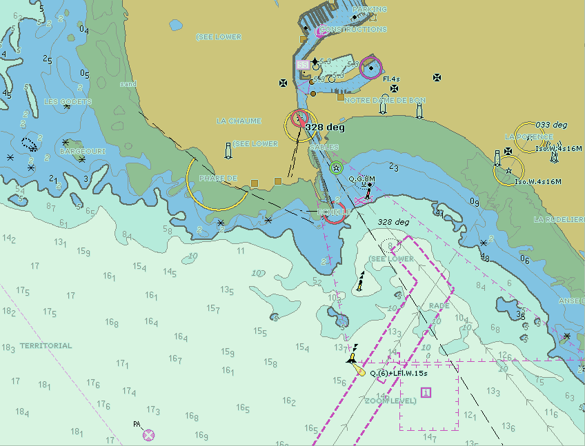 S-57 ENC charts
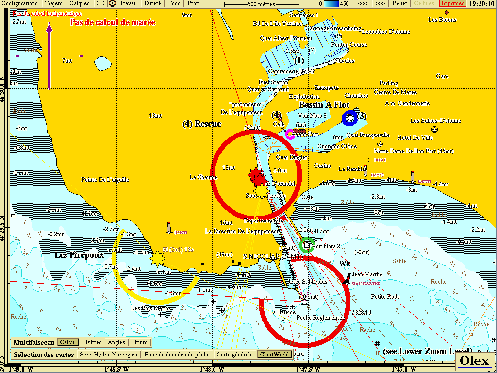 Chartworld Navionics charts
Updated : October 2026